
664 Bus Route Map
View the 664 route map and see all 664 stops along the route. The map of 664 shows where the bus travels and the location of each stop, making it easy to understand the entire route at a glance.
Explore Stadtwerke Remscheid routes on the map and see where Stadtwerke Remscheid bus services operate. Use the 664 map to find bus stops and see how the 664 connects different areas along its trip.
All 664 stops on the map are displayed in route order, helping you follow the 664 bus from the first stop to the last.
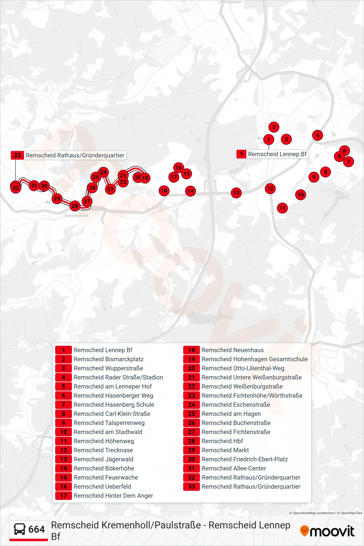
Stops list (664 - Remscheid Rathaus/Gründerquartier)
- Remscheid Lennep Bf
- Remscheid Bismarckplatz
- Remscheid Wupperstraße
- Remscheid Rader Straße/Stadion
- Remscheid am Lenneper Hof
- Remscheid Hasenberger Weg
- Remscheid Hasenberg Schule
- Remscheid Carl-Klein-Straße
- Remscheid Talsperrenweg
- Remscheid am Stadtwald
- Remscheid Höhenweg
- Remscheid Trecknase
- Remscheid Jägerwald
- Remscheid Bökerhöhe
- Remscheid Feuerwache
- Remscheid Ueberfeld
- Remscheid Hinter Dem Anger
- Remscheid Neuenhaus
- Remscheid Hohenhagen Gesamtschule
- Remscheid Otto-Lilienthal-Weg
- Remscheid Untere Weißenburgstraße
- Remscheid Weißenburgstraße
- Remscheid Fichtenhöhe/Wörthstraße
- Remscheid Eschenstraße
- Remscheid am Hagen
- Remscheid Buchenstraße
- Remscheid Fichtenstraße
- Remscheid Hbf
- Remscheid Markt
- Remscheid Friedrich-Ebert-Platz
- Remscheid Allee-Center
- Remscheid Rathaus/Gründerquartier
- Remscheid Rathaus/Gründerquartier
Change direction
- Route Map - 664 - Remscheid Hbf
- Route Map - 664 - Remscheid Hohenhagen Gesamtschule
- Route Map - 664 - Remscheid Lennep Bf
- Route Map - 664 - Remscheid Neuenhaus
- Route Map - 664 - Remscheid Friedrich-Ebert-Platz
- Route Map - 664 - Remscheid Neuenkamp/Stadtwerke
- Route Map - 664 - Remscheid Rader Straße/Stadion
- Route Map - 664 - Remscheid Amtsgericht
- Route Map - 664 - Remscheid Rathaus/Gründerquartier
- Route Map - 664 - Remscheid Friedrich-Ebert-Platz
- Route Map - 664 - Remscheid Kremenholl/Paulstraße