
67 Bus Route Map
View the 67 route map and see all 67 stops along the route. The map of 67 shows where the bus travels and the location of each stop, making it easy to understand the entire route at a glance.
Explore Autobuses routes on the map and see where Autobuses bus services operate. Use the 67 map to find bus stops and see how the 67 connects different areas along its trip.
All 67 stops on the map are displayed in route order, helping you follow the 67 bus from the first stop to the last.
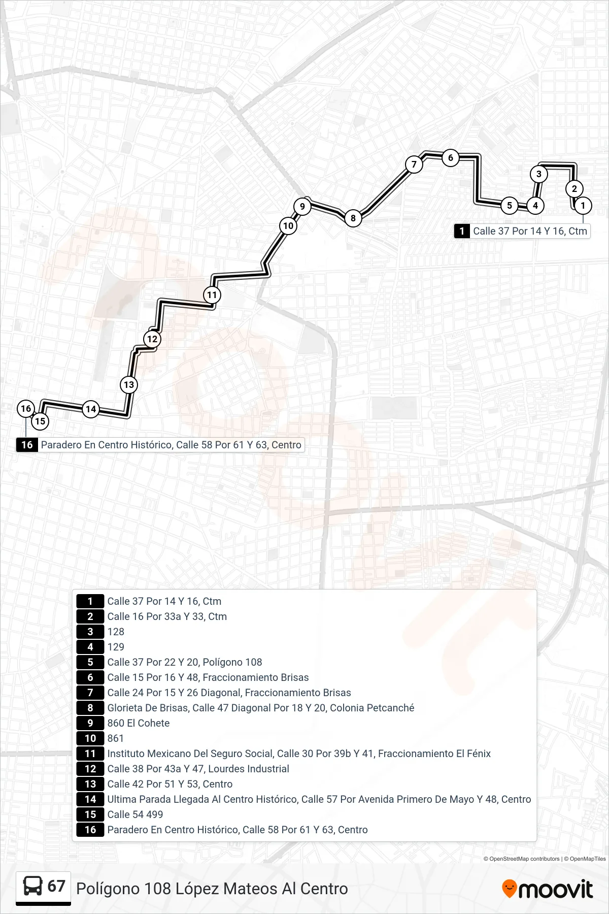
Stops list (67 - Polígono 108 López Mateos Al Centro)
- Calle 37 Por 14 Y 16, Ctm
- Calle 16 Por 33a Y 33, Ctm
- 128
- 129
- Calle 37 Por 22 Y 20, Polígono 108
- Calle 15 Por 16 Y 48, Fraccionamiento Brisas
- Calle 24 Por 15 Y 26 Diagonal, Fraccionamiento Brisas
- Glorieta De Brisas, Calle 47 Diagonal Por 18 Y 20, Colonia Petcanché
- 860 El Cohete
- 861
- Instituto Mexicano Del Seguro Social, Calle 30 Por 39b Y 41, Fraccionamiento El Fénix
- Calle 38 Por 43a Y 47, Lourdes Industrial
- Calle 42 Por 51 Y 53, Centro
- Ultima Parada Llegada Al Centro Histórico, Calle 57 Por Avenida Primero De Mayo Y 48, Centro
- Calle 54 499
- Paradero En Centro Histórico, Calle 58 Por 61 Y 63, Centro