
67 Bus Route Map
View the 67 route map and see all 67 stops along the route. The map of 67 shows where the bus travels and the location of each stop, making it easy to understand the entire route at a glance.
Explore AC Transit routes on the map and see where AC Transit bus services operate. Use the 67 map to find bus stops and see how the 67 connects different areas along its trip.
All 67 stops on the map are displayed in route order, helping you follow the 67 bus from the first stop to the last.
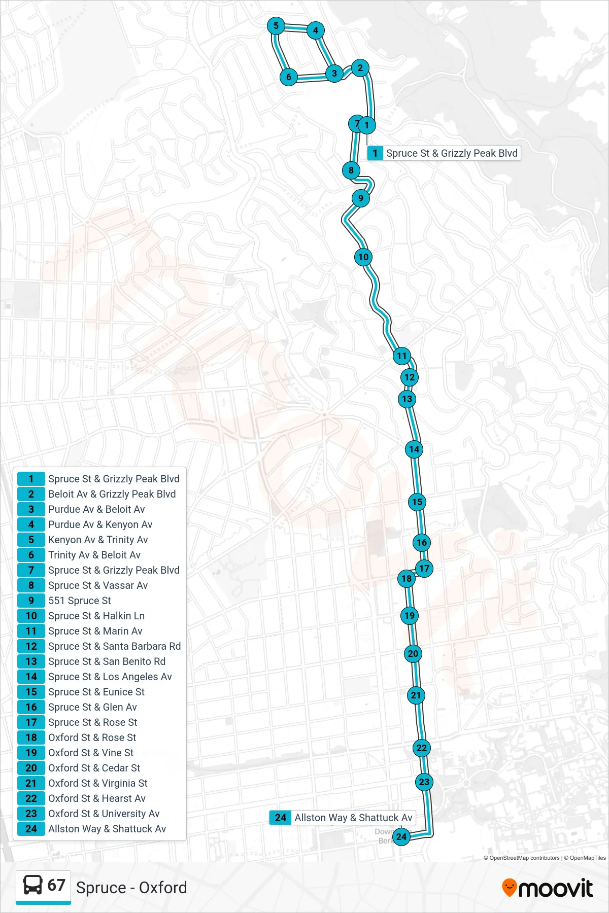
Stops list (67 - Downtown Berkeley)
- Spruce St & Grizzly Peak Blvd
- Beloit Av & Grizzly Peak Blvd
- Purdue Av & Beloit Av
- Purdue Av & Kenyon Av
- Kenyon Av & Trinity Av
- Trinity Av & Beloit Av
- Spruce St & Grizzly Peak Blvd
- Spruce St & Vassar Av
- 551 Spruce St
- Spruce St & Halkin Ln
- Spruce St & Marin Av
- Spruce St & Santa Barbara Rd
- Spruce St & San Benito Rd
- Spruce St & Los Angeles Av
- Spruce St & Eunice St
- Spruce St & Glen Av
- Spruce St & Rose St
- Oxford St & Rose St
- Oxford St & Vine St
- Oxford St & Cedar St
- Oxford St & Virginia St
- Oxford St & Hearst Av
- Oxford St & University Av
- Allston Way & Shattuck Av