
68 Bus Route Map
View the 68 route map and see all 68 stops along the route. The map of 68 shows where the bus travels and the location of each stop, making it easy to understand the entire route at a glance.
Explore Movia routes on the map and see where Movia bus services operate. Use the 68 map to find bus stops and see how the 68 connects different areas along its trip.
All 68 stops on the map are displayed in route order, helping you follow the 68 bus from the first stop to the last.
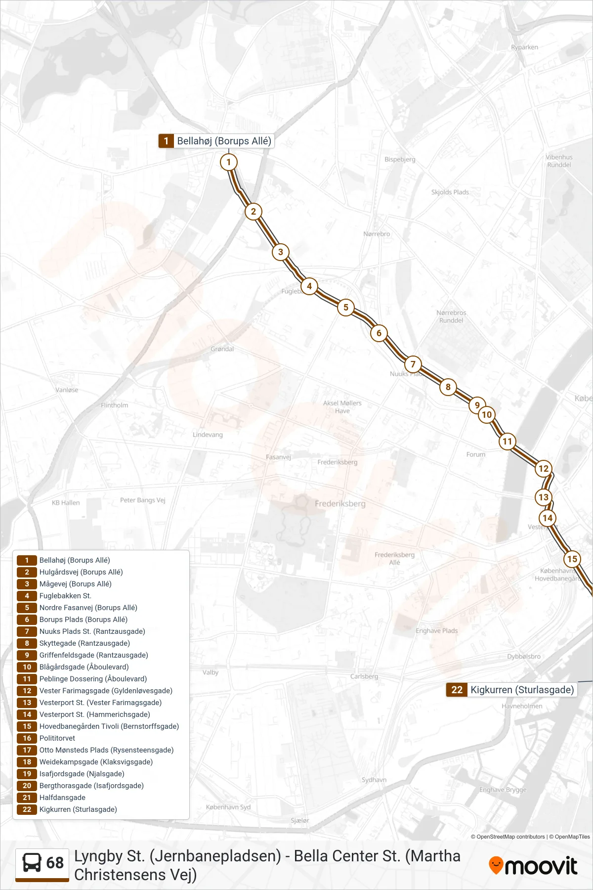
Stops list (68 - Islands Brygge Kigkurren)
- Bellahøj (Borups Allé)
- Hulgårdsvej (Borups Allé)
- Mågevej (Borups Allé)
- Fuglebakken St.
- Nordre Fasanvej (Borups Allé)
- Borups Plads (Borups Allé)
- Nuuks Plads St. (Rantzausgade)
- Skyttegade (Rantzausgade)
- Griffenfeldsgade (Rantzausgade)
- Blågårdsgade (Åboulevard)
- Peblinge Dossering (Åboulevard)
- Vester Farimagsgade (Gyldenløvesgade)
- Vesterport St. (Vester Farimagsgade)
- Vesterport St. (Hammerichsgade)
- Hovedbanegården Tivoli (Bernstorffsgade)
- Polititorvet
- Otto Mønsteds Plads (Rysensteensgade)
- Weidekampsgade (Klaksvigsgade)
- Isafjordsgade (Njalsgade)
- Bergthorasgade (Isafjordsgade)
- Halfdansgade
- Kigkurren (Sturlasgade)
Change direction
- Route Map - 68 - Gladsaxe Trafikplads Via Utterslev Torv
- Route Map - 68 - Kigkurren (Sturlasgade)
- Route Map - 68 - Lyngby St. Via Mellemvangen
- Route Map - 68 - Gladsaxe Trafikplads Via Mellemvangen
- Route Map - 68 - Gladsaxe Trafikplads
- Route Map - 68 - Lyngby St. (Jernbanepladsen)
- Route Map - 68 - Gladsaxe Trafikplads Terminalen
- Route Map - 68 - Bellahøj
- Route Map - 68 - Bella Center
- Route Map - 68 - Bella Center St. (Martha Christensens Vej)