
68 Bus Route Map
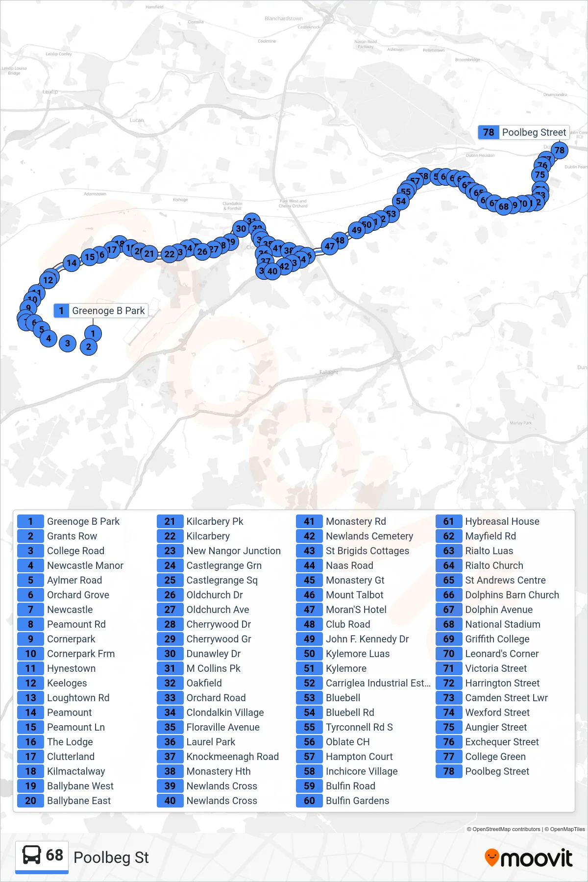
View the 68 route map and see all 68 stops along the route. The map of 68 shows where the bus travels and the location of each stop, making it easy to understand the entire route at a glance.
Explore Bus Átha Cliath – Dublin Bus routes on the map and see where Bus Átha Cliath – Dublin Bus bus services operate. Use the 68 map to find bus stops and see how the 68 connects different areas along its trip.
All 68 stops on the map are displayed in route order, helping you follow the 68 bus from the first stop to the last.
Stops list (68 - Poolbeg St)
- Greenoge B Park
- Grants Row
- College Road
- Newcastle Manor
- Aylmer Road
- Orchard Grove
- Newcastle
- Peamount Rd
- Cornerpark
- Cornerpark Frm
- Hynestown
- Keeloges
- Loughtown Rd
- Peamount
- Peamount Ln
- The Lodge
- Clutterland
- Kilmactalway
- Ballybane West
- Ballybane East
- Kilcarbery Pk
- Kilcarbery
- New Nangor Junction
- Castlegrange Grn
- Castlegrange Sq
- Oldchurch Dr
- Oldchurch Ave
- Cherrywood Dr
- Cherrywood Gr
- Dunawley Dr
- M Collins Pk
- Oakfield
- Orchard Road
- Clondalkin Village
- Floraville Avenue
- Laurel Park
- Knockmeenagh Road
- Monastery Hth
- Newlands Cross
- Newlands Cross
- Monastery Rd
- Newlands Cemetery
- St Brigids Cottages
- Naas Road
- Monastery Gt
- Mount Talbot
- Moran'S Hotel
- Club Road
- John F. Kennedy Dr
- Kylemore Luas
- Kylemore
- Carriglea Industrial Estate
- Bluebell
- Bluebell Rd
- Tyrconnell Rd S
- Oblate CH
- Hampton Court
- Inchicore Village
- Bulfin Road
- Bulfin Gardens
- Hybreasal House
- Mayfield Rd
- Rialto Luas
- Rialto Church
- St Andrews Centre
- Dolphins Barn Church
- Dolphin Avenue
- National Stadium
- Griffith College
- Leonard's Corner
- Victoria Street
- Harrington Street
- Camden Street Lwr
- Wexford Street
- Aungier Street
- Exchequer Street
- College Green
- Poolbeg Street