
68 Bus Route Map
View the 68 route map and see all 68 stops along the route. The map of 68 shows where the bus travels and the location of each stop, making it easy to understand the entire route at a glance.
Explore Sonoma County Transit routes on the map and see where Sonoma County Transit bus services operate. Use the 68 map to find bus stops and see how the 68 connects different areas along its trip.
All 68 stops on the map are displayed in route order, helping you follow the 68 bus from the first stop to the last.
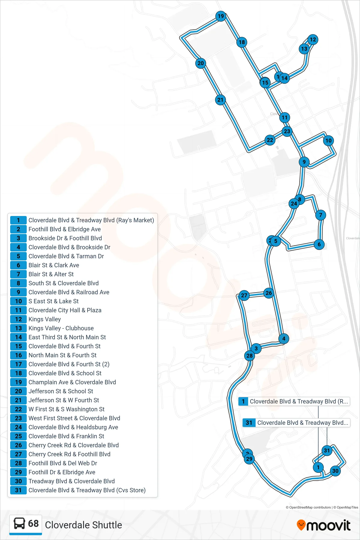
Stops list (68 - Cloverdale Shuttle)
- Cloverdale Blvd & Treadway Blvd (Ray's Market)
- Foothill Blvd & Elbridge Ave
- Brookside Dr & Foothill Blvd
- Cloverdale Blvd & Brookside Dr
- Cloverdale Blvd & Tarman Dr
- Blair St & Clark Ave
- Blair St & Alter St
- South St & Cloverdale Blvd
- Cloverdale Blvd & Railroad Ave
- S East St & Lake St
- Cloverdale City Hall & Plaza
- Kings Valley
- Kings Valley - Clubhouse
- East Third St & North Main St
- Cloverdale Blvd & Fourth St
- North Main St & Fourth St
- Cloverdale Blvd & Fourth St (2)
- Cloverdale Blvd & School St
- Champlain Ave & Cloverdale Blvd
- Jefferson St & School St
- Jefferson St & W Fourth St
- W First St & S Washington St
- West First Street & Cloverdale Blvd
- Cloverdale Blvd & Healdsburg Ave
- Cloverdale Blvd & Franklin St
- Cherry Creek Rd & Cloverdale Blvd
- Cherry Creek Rd & Foothill Blvd
- Foothill Blvd & Del Web Dr
- Foothill Dr & Elbridge Ave
- Treadway Blvd & Cloverdale Blvd
- Cloverdale Blvd & Treadway Blvd (Cvs Store)