
68 Bus Route Map
View the 68 route map and see all 68 stops along the route. The map of 68 shows where the bus travels and the location of each stop, making it easy to understand the entire route at a glance.
Explore GTT Suburban Service routes on the map and see where GTT Suburban Service bus services operate. Use the 68 map to find bus stops and see how the 68 connects different areas along its trip.
All 68 stops on the map are displayed in route order, helping you follow the 68 bus from the first stop to the last.
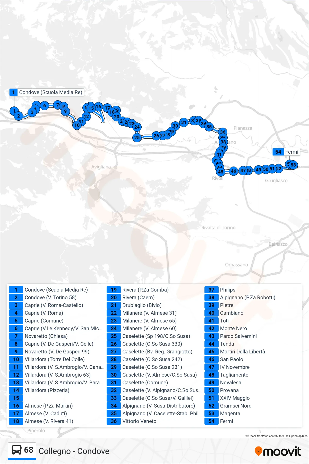
Stops list (68 - Collegno Fermi Station)
- Condove (Re Middle School)
- Condove (Turin St 58)
- Caprie (Roma Street-Castle)
- Caprie (Roma Street)
- Caprie (Town Hall)
- Caprie (Kennedy Ave/San Michele St)
- Novaretto (Church)
- Caprie (De Gasperi St/Celle St)
- Novaretto (De Gasperi St 99)
- Villardora (Tower of the Hill)
- Villardora (Via S.Ambrogio/Via Canavere)
- Villardora (Via San Ambrogio 63)
- Villardora (Via Sant'Ambrogio/Via Baratta)
- Villardora (Pizzeria)
- _
- Almese (Martyrs Square)
- Almese (Fallen St.)
- Almese (Rivera St 41)
- Rivera (Comba Square)
- Rivera (Caem)
- Drubiaglio (Junction)
- Milanere (Almese Street 31)
- Milanere (Almese St. 65)
- Milanere (Almese Street 60)
- Caselette (Route 198/Corso Susa)
- Caselette (Susa Course 330)
- Caselette (Grangiotto Junction)
- Caselette (Susa Course 242)
- Caselette (Susa Course 231)
- Caselette (Via Almese/Corso Susa)
- Caselette (Town Hall)
- Caselette (Alpignano St/Susa Course)
- Caselette (Susa Course/Galilei Street)
- Alpignano (Susa Street-Gas Station)
- Alpignano (V. Caselette-Philips Factory)
- Vittorio Veneto
- Philips
- Alpignano (Robotti Square)
- Stones
- Cambiano
- Toti
- Monte Nero
- Salvemini Park
- Tent
- Liberty Martyrs
- San Paolo
- IV November
- Tagliamento
- Novalesa
- Provana
- XXIV May
- Gramsci North
- Magenta
- Fermi