
689 Bus Route Map
View the 689 route map and see all 689 stops along the route. The map of 689 shows where the bus travels and the location of each stop, making it easy to understand the entire route at a glance.
Explore Metropoline routes on the map and see where Metropoline bus services operate. Use the 689 map to find bus stops and see how the 689 connects different areas along its trip.
All 689 stops on the map are displayed in route order, helping you follow the 689 bus from the first stop to the last.
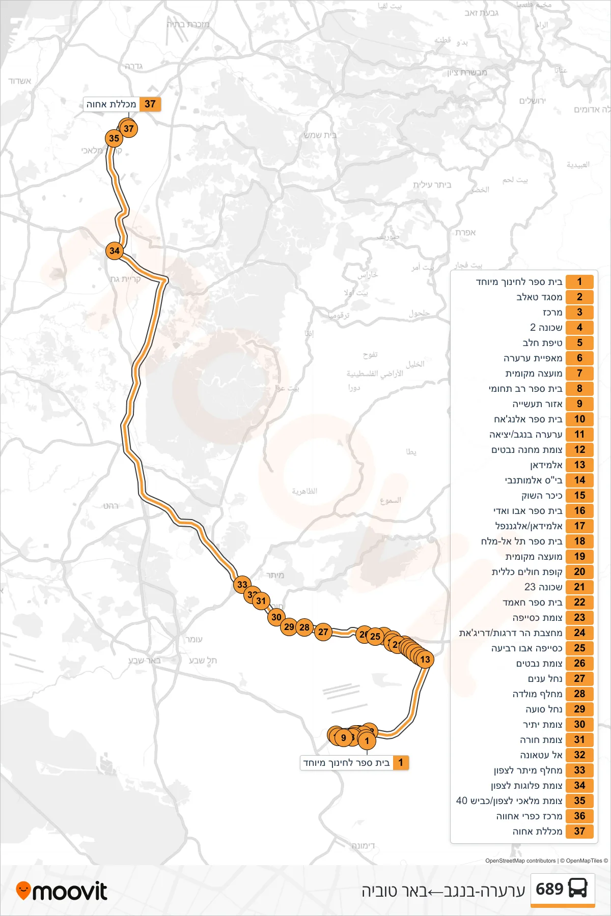
Stops list (689 - Ar'ara BaNegev→Be'er Tuvya)
- Special Education School
- Taleb Mosque
- Center
- Neighborhood 2
- Tipat Halav
- Ar'ara Bakery
- Local Council
- Multi-Disciplinary School
- Industrial Zone
- Al-Najah School
- Ar'ara Banegev/Exit
- Nevatim Camp Junction
- Al-Midan
- Al-Mutanabbi School
- Market Square
- Abu Wadi School
- Al Midan/Al-Ganafel
- Tel Al-Melach School
- Local Council
- Health Clinic
- Neighborhood 23
- Hamed School
- Kuseife Junction
- Har Dragot Quarry/Drijat
- Kuseife Abu Rabia
- Nevatim Junction
- Nahal Anim
- Molada Junction
- Nachal Sua
- Yatir Junction
- Hura Junction
- Al Atauna
- Meitar Interchange North
- Plugot Junction North
- Malachi North Junction/Road 40
- Ahava Rural Center
- Achva College