
69 Bus Route Map
View the 69 route map and see all 69 stops along the route. The map of 69 shows where the bus travels and the location of each stop, making it easy to understand the entire route at a glance.
Explore Rhode Island Public Transit Authority routes on the map and see where Rhode Island Public Transit Authority bus services operate. Use the 69 map to find bus stops and see how the 69 connects different areas along its trip.
All 69 stops on the map are displayed in route order, helping you follow the 69 bus from the first stop to the last.
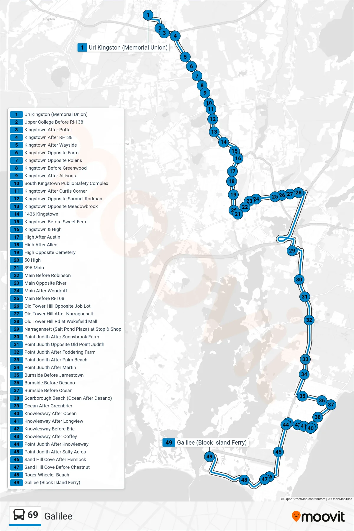
Stops list (69 - Galilee)
- Uri Kingston (Memorial Union)
- Upper College Before Ri-138
- Kingstown After Potter
- Kingstown After Ri-138
- Kingstown After Wayside
- Kingstown Opposite Farm
- Kingstown Opposite Rolens
- Kingstown Before Greenwood
- Kingstown After Allisons
- South Kingstown Public Safety Complex
- Kingstown After Curtis Corner
- Kingstown Opposite Samuel Rodman
- Kingstown Opposite Meadowbrook
- 1436 Kingstown
- Kingstown Before Sweet Fern
- Kingstown & High
- High After Austin
- High After Allen
- High Opposite Cemetery
- 50 High
- 396 Main
- Main Before Robinson
- Main Opposite River
- Main After Woodruff
- Main Before Ri-108
- Old Tower Hill Opposite Job Lot
- Old Tower Hill After Narragansett
- Old Tower Hill Rd at Wakefield Mall
- Narragansett (Salt Pond Plaza) at Stop & Shop
- Point Judith After Sunnybrook Farm
- Point Judith Opposite Old Point Judith
- Point Judith After Foddering Farm
- Point Judith After Palm Beach
- Point Judith After Martin
- Burnside Before Jamestown
- Burnside Before Desano
- Burnside Before Ocean
- Scarborough Beach (Ocean After Desano)
- Ocean After Greenbrier
- Knowlesway After Ocean
- Knowlesway After Longview
- Knowlesway Before Erie
- Knowlesway After Coffey
- Point Judith After Knowlesway
- Point Judith After Salty Acres
- Sand Hill Cove After Hemlock
- Sand Hill Cove Before Chestnut
- Roger Wheeler Beach
- Galilee (Block Island Ferry)