
69 Bus Route Map
View the 69 route map and see all 69 stops along the route. The map of 69 shows where the bus travels and the location of each stop, making it easy to understand the entire route at a glance.
Explore Metropoline routes on the map and see where Metropoline bus services operate. Use the 69 map to find bus stops and see how the 69 connects different areas along its trip.
All 69 stops on the map are displayed in route order, helping you follow the 69 bus from the first stop to the last.
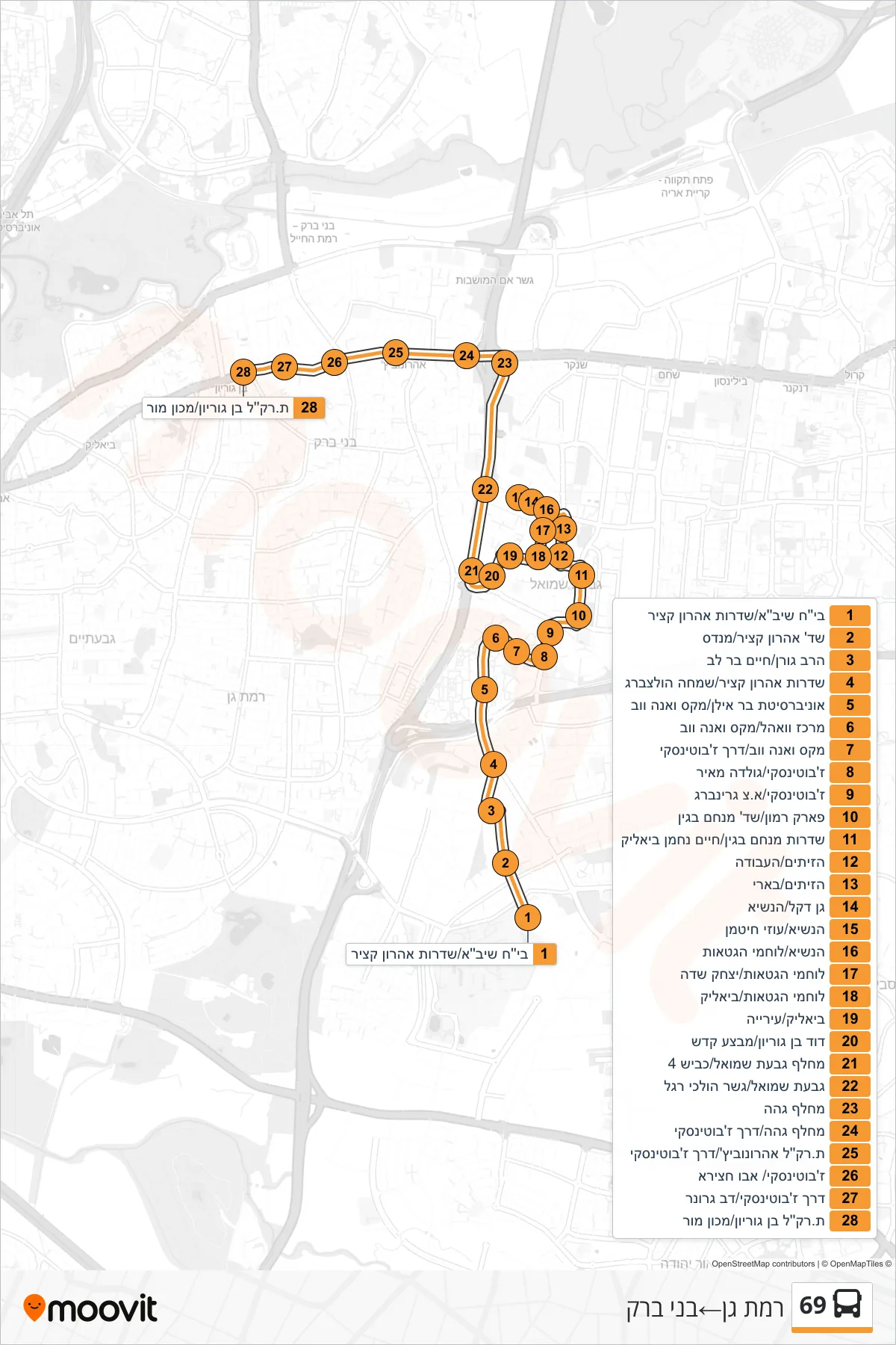

Stops list (69 - Ramat Gan→Bnei Brak)
- Sheba Hospital/Aharon Katzir Boulevard
- Aaron Katzir Boulevard/Mendes
- Rabbi Goren/Chaim Bar Lev
- Aaron Katzir Boulevard/Simcha Holtzberg
- Bar Ilan University/Max and Anna Webb
- Wohl Center/Max and Anna Webb
- Max and Anna Webb/Jabotinsky Road
- Jabotinsky/Golda Meir
- Jabotinsky/A.Z. Greenberg
- Ramon Park/Menachem Begin Blvd
- Menachem Begin Boulevard/Chaim Nachman Bialik
- HaZeitim/HaAvoda
- HaZeitim/Be'eri
- Gan Dekel/HaNasi
- HaNasi/Uzi Hitman
- HaNasi/Lohamei HaGeta'ot
- Lohamei HaGetaot/Yitzhak Sadeh
- Lohamei HaGeta'ot/Bialik
- Bialik/City Hall
- David Ben Gurion/Mivtza Kadesh
- Givat Shmuel Interchange/Road 4
- Givat Shmuel/Pedestrian Bridge
- Geha Interchange
- Geha Junction/Jabotinsky Road
- Aharonowitz Light Rail Station/Jabotinsky Road
- Jabotinsky/Abu Hatseira
- Jabotinsky Road/Dov Gruner
- Light Rail Station Ben Gurion/Machon Mor