
69 Bus Route Map
View the 69 route map and see all 69 stops along the route. The map of 69 shows where the bus travels and the location of each stop, making it easy to understand the entire route at a glance.
Explore KP Kyivpastrans routes on the map and see where KP Kyivpastrans bus services operate. Use the 69 map to find bus stops and see how the 69 connects different areas along its trip.
All 69 stops on the map are displayed in route order, helping you follow the 69 bus from the first stop to the last.
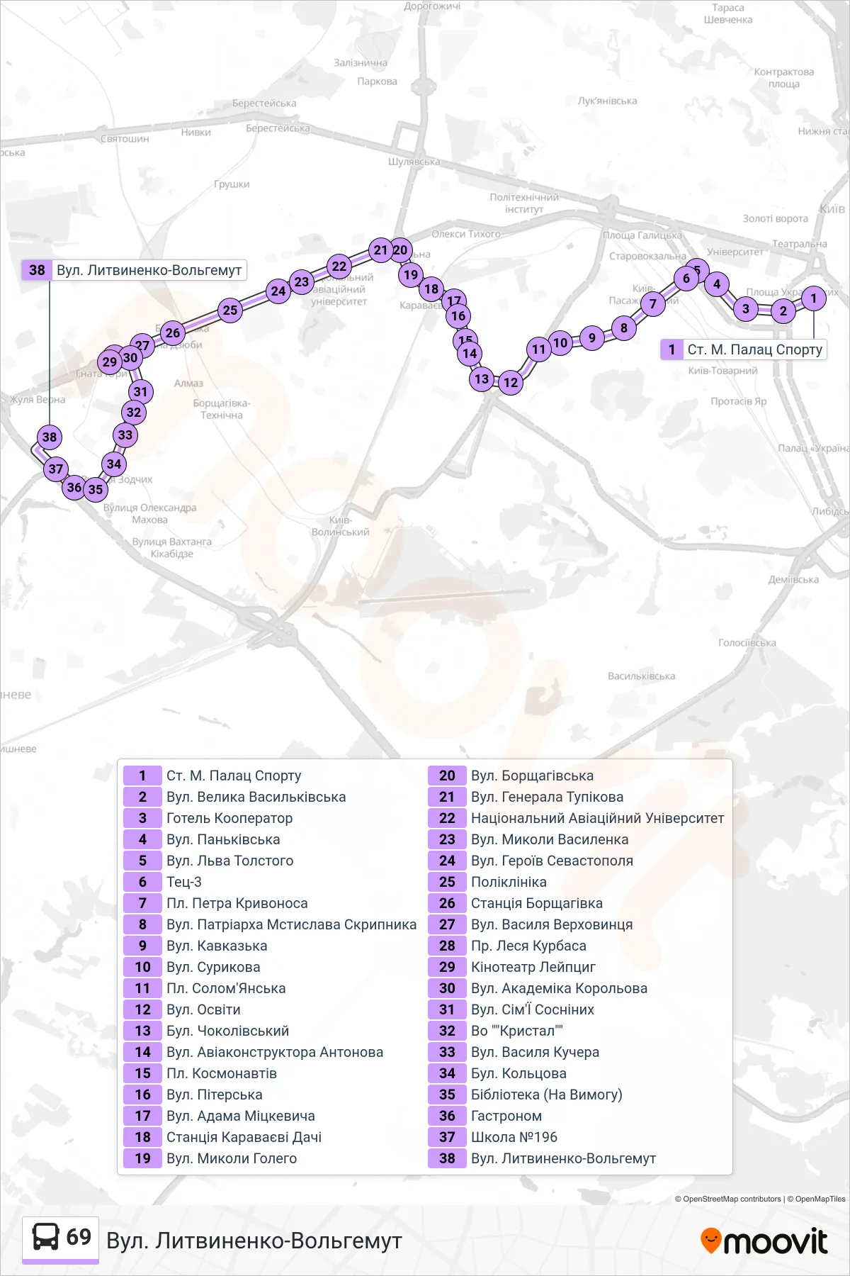
Stops list (69 - Lytvynenko-Volhemut Street)
- Palace of Sports Metro Station
- Velyka Vasylkivska St
- Hotel Kooperator
- Pankivska Street
- Leo Tolstoy Street
- TEC-3
- Petro Kryvonos Square
- Patriarch Mstyslav Skrypnyk Street
- Kavkazka Street
- Surikov Street
- Solomyanska Square
- Osvity Street
- Chokolivskyi Boulevard
- Aircraft Designer Antonov Street
- Kosmonavtiv Square
- Piterska Street
- Adam Mickiewicz Street
- Karavaevi Dachi Station
- Mykola Holoho Street
- Borshchahivska St
- General Tupikov Street
- National Aviation University
- Mykoly Vasylenka Street
- Heroes of Sevastopol Street
- Polyclinic
- Borshchahivka Station
- Vasyl Verkhovynets St
- Les Kurbas Avenue
- Leipzig Cinema
- Akademika Korolova Street
- Simi Sosninykh St
- Crystal Factory
- Vasyl Kucher Street
- Koltsova Blvd
- Library (On Request)
- Grocery Store
- School No. 196
- Lytvynenko-Volhemut Street