
69 Bus Route Map
View the 69 route map and see all 69 stops along the route. The map of 69 shows where the bus travels and the location of each stop, making it easy to understand the entire route at a glance.
Explore Niederrheinische VKB routes on the map and see where Niederrheinische VKB bus services operate. Use the 69 map to find bus stops and see how the 69 connects different areas along its trip.
All 69 stops on the map are displayed in route order, helping you follow the 69 bus from the first stop to the last.
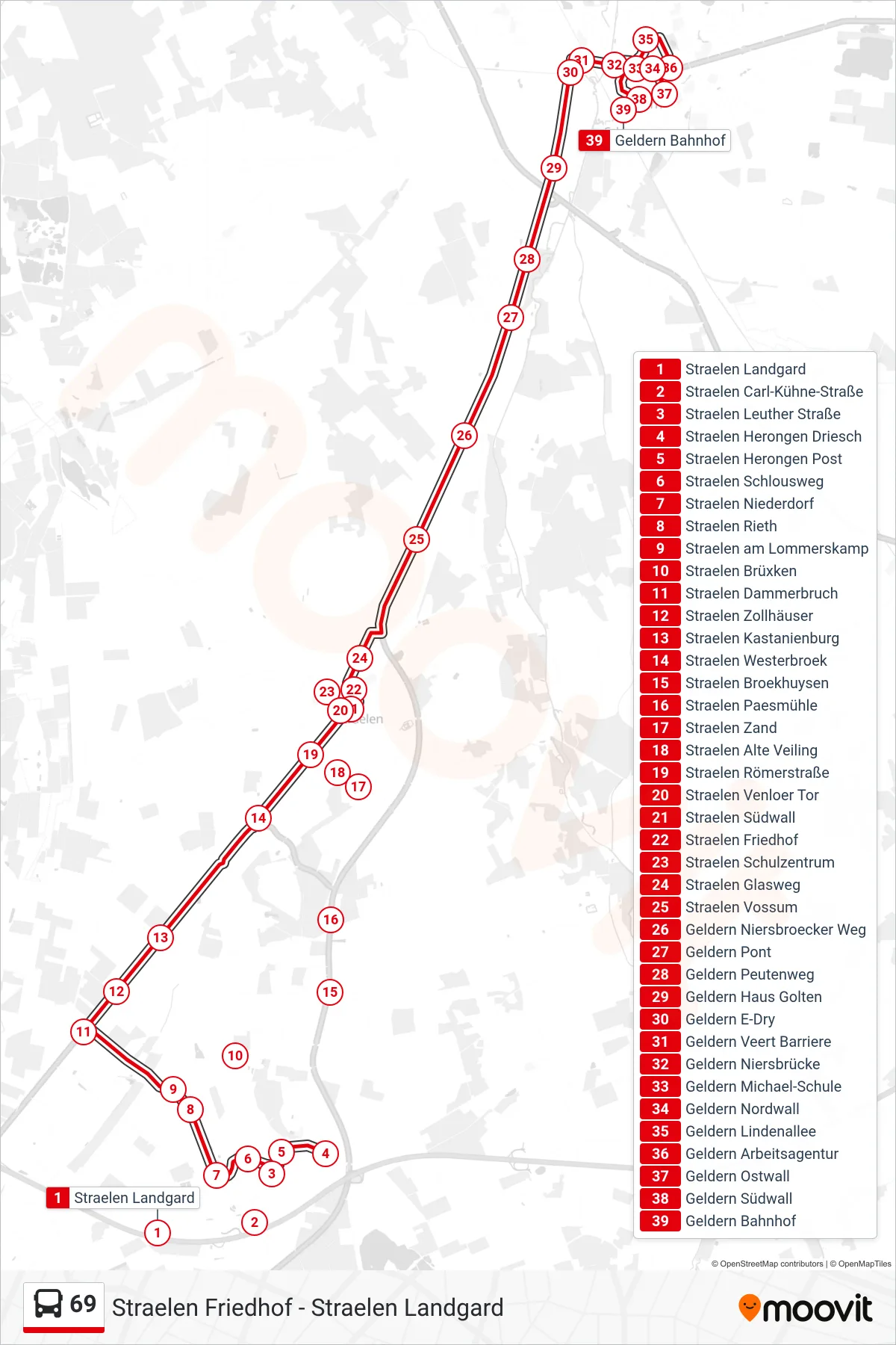
Stops list (69 - Geldern Bahnhof)
- Straelen Landgard
- Straelen Carl-Kühne-Straße
- Straelen Leuther Straße
- Straelen Herongen Driesch
- Straelen Herongen Post
- Straelen Schlousweg
- Straelen Niederdorf
- Straelen Rieth
- Straelen am Lommerskamp
- Straelen Brüxken
- Straelen Dammerbruch
- Straelen Zollhäuser
- Straelen Kastanienburg
- Straelen Westerbroek
- Straelen Broekhuysen
- Straelen Paesmühle
- Straelen Zand
- Straelen Alte Veiling
- Straelen Römerstraße
- Straelen Venloer Tor
- Straelen Südwall
- Straelen Friedhof
- Straelen Schulzentrum
- Straelen Glasweg
- Straelen Vossum
- Geldern Niersbroecker Weg
- Geldern Pont
- Geldern Peutenweg
- Geldern Haus Golten
- Geldern E-Dry
- Geldern Veert Barriere
- Geldern Niersbrücke
- Geldern Michael-Schule
- Geldern Nordwall
- Geldern Lindenallee
- Geldern Arbeitsagentur
- Geldern Ostwall
- Geldern Südwall
- Geldern Bahnhof