
694 Bus Route Map
View the 694 route map and see all 694 stops along the route. The map of 694 shows where the bus travels and the location of each stop, making it easy to understand the entire route at a glance.
Explore Verkehrsverbund Potsdam routes on the map and see where Verkehrsverbund Potsdam bus services operate. Use the 694 map to find bus stops and see how the 694 connects different areas along its trip.
All 694 stops on the map are displayed in route order, helping you follow the 694 bus from the first stop to the last.
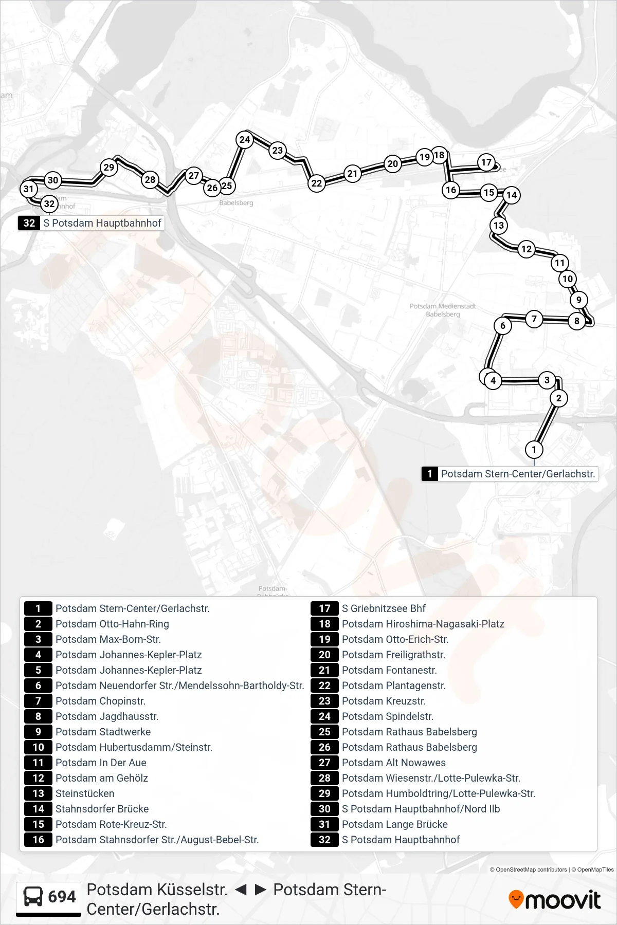
Stops list (694 - S Potsdam Hauptbahnhof)
- Potsdam Stern-Center/Gerlachstr.
- Potsdam Otto-Hahn-Ring
- Potsdam Max-Born-Str.
- Potsdam Johannes-Kepler-Platz
- Potsdam Johannes-Kepler-Platz
- Potsdam Neuendorfer Str./Mendelssohn-Bartholdy-Str.
- Potsdam Chopinstr.
- Potsdam Jagdhausstr.
- Potsdam Stadtwerke
- Potsdam Hubertusdamm/Steinstr.
- Potsdam In Der Aue
- Potsdam am Gehölz
- Steinstücken
- Stahnsdorfer Brücke
- Potsdam Rote-Kreuz-Str.
- Potsdam Stahnsdorfer Str./August-Bebel-Str.
- S Griebnitzsee Bhf
- Potsdam Hiroshima-Nagasaki-Platz
- Potsdam Otto-Erich-Str.
- Potsdam Freiligrathstr.
- Potsdam Fontanestr.
- Potsdam Plantagenstr.
- Potsdam Kreuzstr.
- Potsdam Spindelstr.
- Potsdam Rathaus Babelsberg
- Potsdam Rathaus Babelsberg
- Potsdam Alt Nowawes
- Potsdam Wiesenstr./Lotte-Pulewka-Str.
- Potsdam Humboldtring/Lotte-Pulewka-Str.
- S Potsdam Hauptbahnhof/Nord Ilb
- Potsdam Lange Brücke
- S Potsdam Hauptbahnhof
Change direction
- Route Map - 694 - Potsdam Stern-Center/Gerlachstr.
- Route Map - 694 - Potsdam Konrad-Wolf-Allee/Sternstr.
- Route Map - 694 - S Potsdam Hauptbahnhof
- Route Map - 694 - Potsdam Johannes-Kepler-Platz
- Route Map - 694 - Potsdam Küsselstr.
- Route Map - 694 - Potsdam Hoffbauer-Stiftung
- Route Map - 694 - S Griebnitzsee Bhf
- Route Map - 694 - Potsdam Rathaus Babelsberg
- Route Map - 694 - Potsdam Rathaus Babelsberg