
69G Bus Route Map
View the 69G route map and see all 69G stops along the route. The map of 69G shows where the bus travels and the location of each stop, making it easy to understand the entire route at a glance.
Explore KSRTC Ordinary Bus Services routes on the map and see where KSRTC Ordinary Bus Services bus services operate. Use the 69G map to find bus stops and see how the 69G connects different areas along its trip.
All 69G stops on the map are displayed in route order, helping you follow the 69G bus from the first stop to the last.
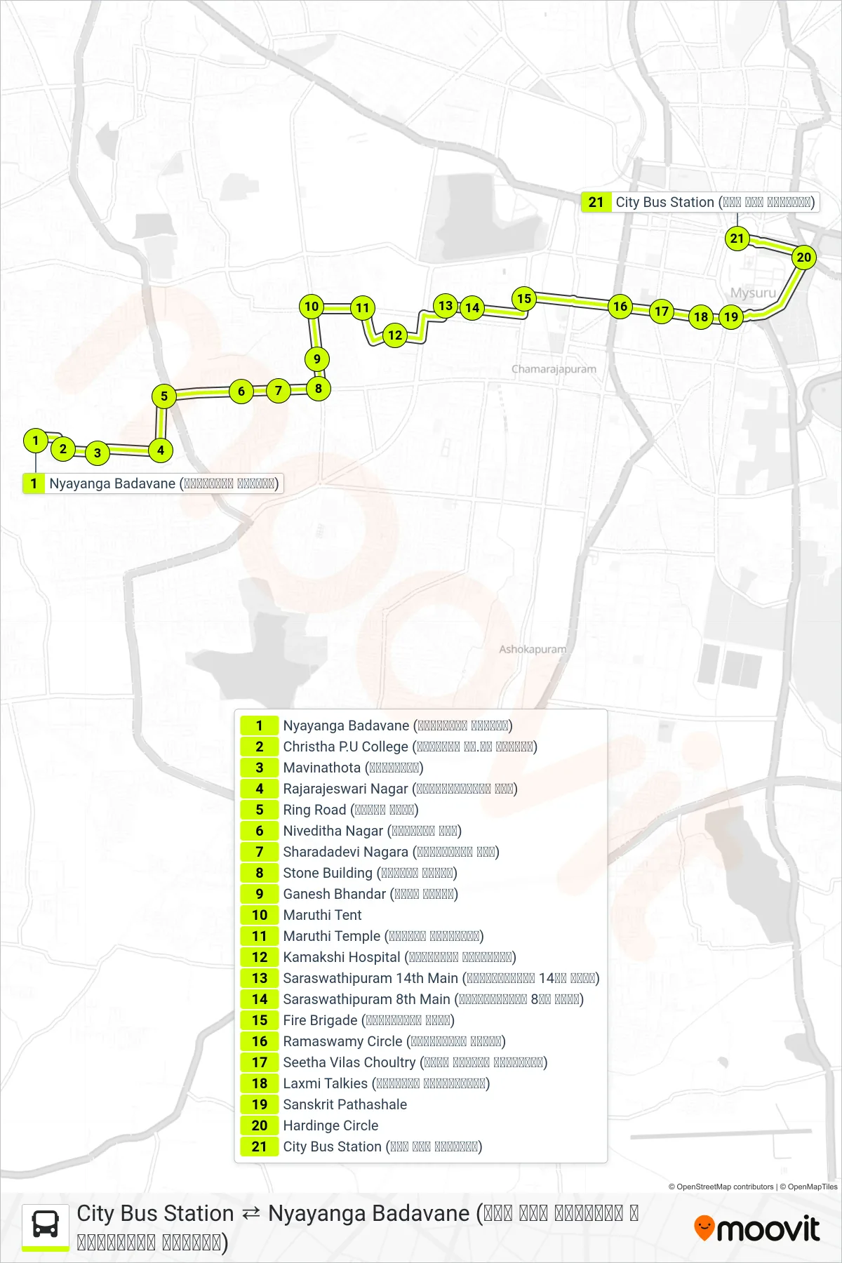
Stops list (69G - → City Bus Station (ನಗರ ಬಸ್ ನಿಲ್ದಾಣ))
- Nyayanga Badavane (ನ್ಯಾಯಾಂಗ ಬಡಾವಣೆ)
- Christha P.U College (ಕ್ರಿಸ್ತ ಪಿ.ಯು ಕಾಲೇಜು)
- Mavinathota (ಮಾವಿನತೋಟ)
- Rajarajeswari Nagar (ರಾಜರಾಜೇಶ್ವರಿ ನಗರ)
- Ring Road (ರಿಂಗ್ ರೋಡ್)
- Niveditha Nagar (ನಿವೇದಿತ ನಗರ)
- Sharadadevi Nagara (ಶಾರದಾದೇವಿ ನಗರ)
- Stone Building (ಕಲ್ಲಿನ ಕಟ್ಟಡ)
- Ganesh Bhandar (ಗಣೇಶ ಭಂಡಾರ)
- Maruthi Tent
- Maruthi Temple (ಮಾರುತಿ ದೇವಸ್ಥಾನ)
- Kamakshi Hospital (ಕಾಮಾಕ್ಷಿ ಆಸ್ಪತ್ರೆ)
- Saraswathipuram 14th Main (ಸರಸ್ವತಿಪುರಂ 14ನೇ ಮೈನ್)
- Saraswathipuram 8th Main (ಸರಸ್ವತಿಪುರಂ 8ನೇ ಮೈನ್)
- Fire Brigade (ಅಗ್ನಿಶಾಮಕ ಠಾಣೆ)
- Ramaswamy Circle (ರಾಮಸ್ವಾಮಿ ವೃತ್ತ)
- Seetha Vilas Choultry (ಸೀತಾ ವಿಲಾಸ್ ಚೌಲ್ಟ್ರಿ)
- Laxmi Talkies (ಲಕ್ಷ್ಮೀ ಚಿತ್ರಮಂದಿರ)
- Sanskrit Pathashale
- Hardinge Circle
- City Bus Station (ನಗರ ಬಸ್ ನಿಲ್ದಾಣ)