
6TR Bus Route Map
View the 6TR route map and see all 6TR stops along the route. The map of 6TR shows where the bus travels and the location of each stop, making it easy to understand the entire route at a glance.
Explore KP Kyivpastrans routes on the map and see where KP Kyivpastrans bus services operate. Use the 6TR map to find bus stops and see how the 6TR connects different areas along its trip.
All 6TR stops on the map are displayed in route order, helping you follow the 6TR bus from the first stop to the last.
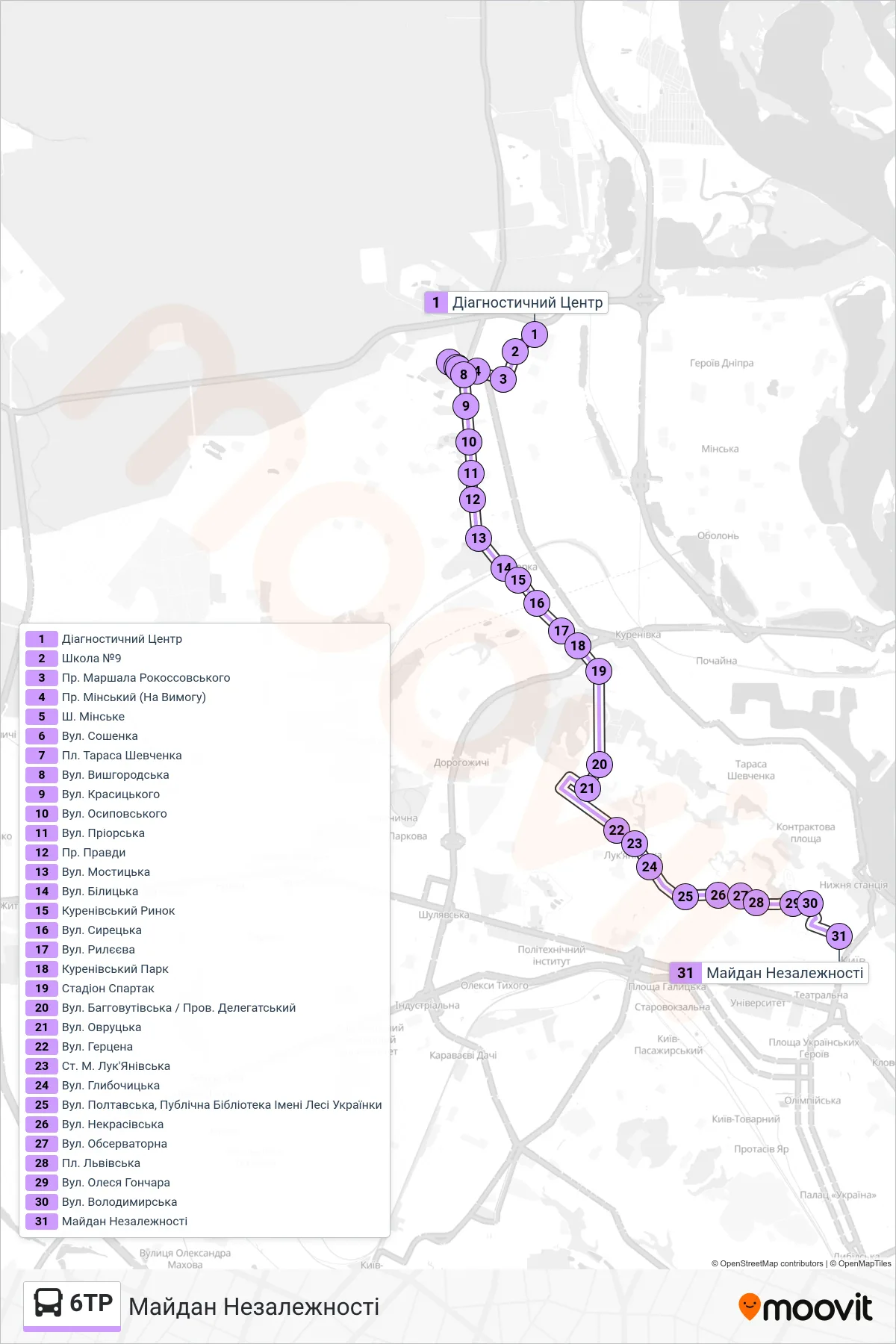
Stops list (6TR - Independence Square)
- Diagnostic Center
- School No. 9
- Marshal Rokossovsky Avenue
- Minskyi Avenue (On Request)
- Minske Highway
- Soshenka St
- Taras Shevchenko Square
- Vyshhorodska Street
- Krasytskoho Street
- Osypovskyi Street
- Priorska Street
- Pravdy Ave
- Mostytska Street
- Bilytska Street
- Kurenivsky Market
- Syretska Street
- Ryleeva Street
- Kurenivsky Park
- Spartak Stadium
- Bahovutivska St / Delegatsky Lane
- Ovrutska St
- Herzen Street
- Lukianivska Metro Station
- Hlybochytska Street
- Poltavska Street, Lesia Ukrainka Public Library
- Nekrasivska Street
- Observatory Street
- Lvivska Square
- Oles Honchar Street
- Volodymyrska St
- Independence Square