
7 Bus Route Map
View the 7 route map and see all 7 stops along the route. The map of 7 shows where the bus travels and the location of each stop, making it easy to understand the entire route at a glance.
Explore Albany Transit System routes on the map and see where Albany Transit System bus services operate. Use the 7 map to find bus stops and see how the 7 connects different areas along its trip.
All 7 stops on the map are displayed in route order, helping you follow the 7 bus from the first stop to the last.
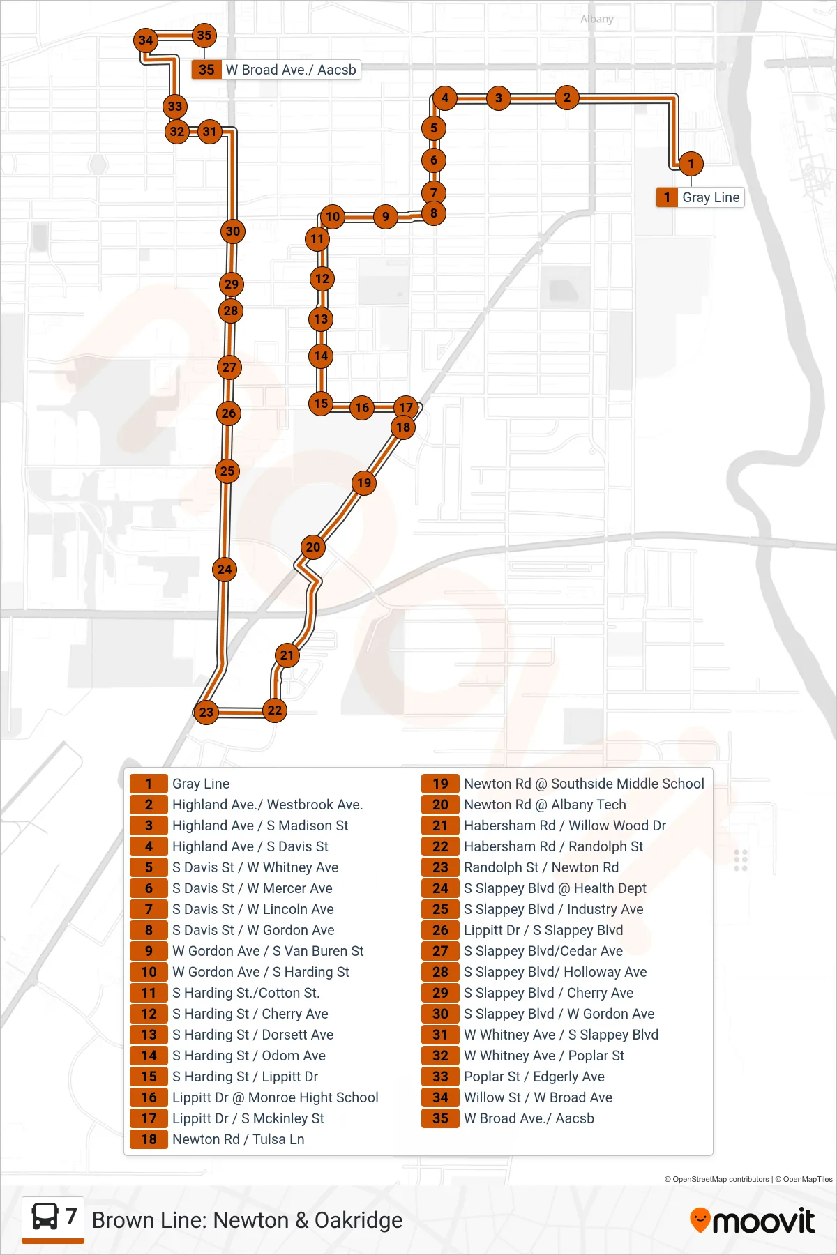
Stops list (7 - )
- Gray Line
- Highland Ave./ Westbrook Ave.
- Highland Ave / S Madison St
- Highland Ave / S Davis St
- S Davis St / W Whitney Ave
- S Davis St / W Mercer Ave
- S Davis St / W Lincoln Ave
- S Davis St / W Gordon Ave
- W Gordon Ave / S Van Buren St
- W Gordon Ave / S Harding St
- S Harding St./Cotton St.
- S Harding St / Cherry Ave
- S Harding St / Dorsett Ave
- S Harding St / Odom Ave
- S Harding St / Lippitt Dr
- Lippitt Dr @ Monroe Hight School
- Lippitt Dr / S Mckinley St
- Newton Rd / Tulsa Ln
- Newton Rd @ Southside Middle School
- Newton Rd @ Albany Tech
- Habersham Rd / Willow Wood Dr
- Habersham Rd / Randolph St
- Randolph St / Newton Rd
- S Slappey Blvd @ Health Dept
- S Slappey Blvd / Industry Ave
- Lippitt Dr / S Slappey Blvd
- S Slappey Blvd/Cedar Ave
- S Slappey Blvd/ Holloway Ave
- S Slappey Blvd / Cherry Ave
- S Slappey Blvd / W Gordon Ave
- W Whitney Ave / S Slappey Blvd
- W Whitney Ave / Poplar St
- Poplar St / Edgerly Ave
- Willow St / W Broad Ave
- W Broad Ave./ Aacsb