
7 Bus Route Map
View the 7 route map and see all 7 stops along the route. The map of 7 shows where the bus travels and the location of each stop, making it easy to understand the entire route at a glance.
Explore ATAC Civitanova S.p.A. routes on the map and see where ATAC Civitanova S.p.A. bus services operate. Use the 7 map to find bus stops and see how the 7 connects different areas along its trip.
All 7 stops on the map are displayed in route order, helping you follow the 7 bus from the first stop to the last.
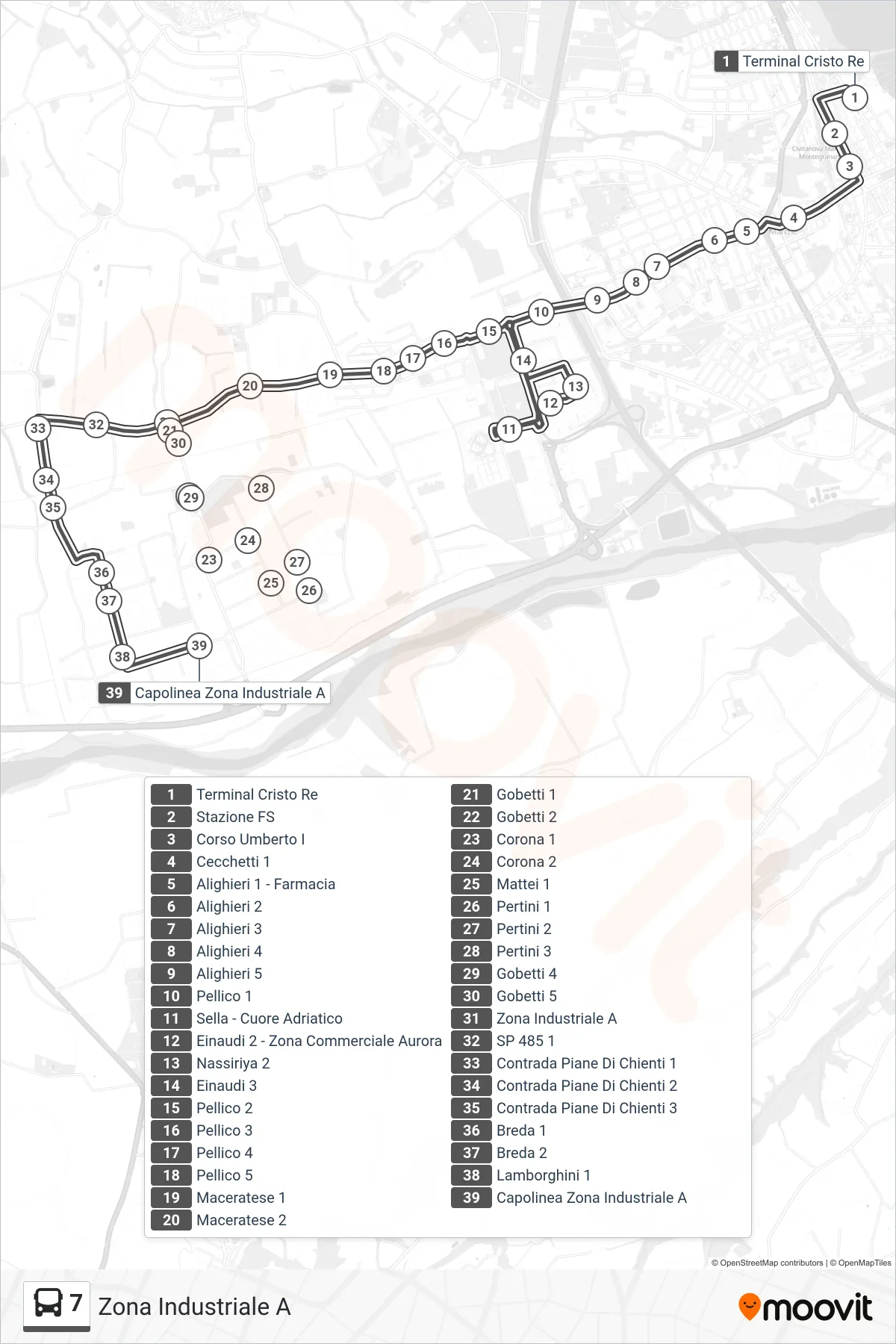
Stops list (7 - Industrial Zone A)
- Cristo Re Terminal
- Railway Station
- Umberto I Avenue
- Cecchetti 1
- Alighieri 1 - Pharmacy
- Alighieri 2
- Alighieri 3
- Alighieri 4
- Alighieri 5
- Pellico 1
- Sella - Adriatic Heart
- Einaudi 2 - Aurora Commercial Zone
- Nassiriya 2
- Einaudi 3
- Pellico 2
- Pellico 3
- Pellico 4
- Pellico 5
- Maceratese 1
- Maceratese 2
- Gobetti 1
- Gobetti 2
- Corona 1
- Corona 2
- Mattei 1
- Pertini 1
- Pertini 2
- Pertini 3
- Gobetti 4
- Gobetti 5
- Industrial Zone A
- SP 485 1
- Piane Di Chienti District 1
- Piane Di Chienti District 2
- Piane Di Chienti District 3
- Breda 1
- Breda 2
- Lamborghini 1
- Industrial Zone A Terminal