
7 Bus Route Map
View the 7 route map and see all 7 stops along the route. The map of 7 shows where the bus travels and the location of each stop, making it easy to understand the entire route at a glance.
Explore Space Coast Area Transit routes on the map and see where Space Coast Area Transit bus services operate. Use the 7 map to find bus stops and see how the 7 connects different areas along its trip.
All 7 stops on the map are displayed in route order, helping you follow the 7 bus from the first stop to the last.
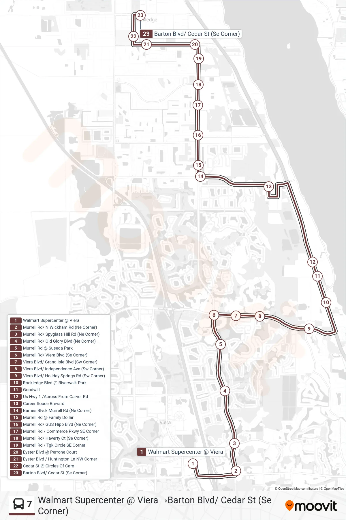
Stops list (7 - Walmart Supercenter @ Viera→Barton Blvd/ Cedar St (Se Corner))
- Walmart Supercenter @ Viera
- Murrell Rd/ N Wickham Rd (Ne Corner)
- Murrell Rd/ Spyglass Hill Rd (Ne Corner)
- Murrell Rd/ Old Glory Blvd (Ne Corner)
- Murrell Rd @ Suseda Park
- Murrell Rd/ Viera Blvd (Se Corner)
- Viera Blvd/ Grand Isle Blvd (Sw Corner)
- Viera Blvd/ Independence Ave (Sw Corner)
- Viera Blvd/ Holiday Springs Rd (Sw Corner)
- Rockledge Blvd @ Riverwalk Park
- Goodwill
- Us Hwy 1 /Across From Carver Rd
- Career Souce Brevard
- Barnes Blvd/ Murrell Rd (Ne Corner)
- Murrell Rd @ Family Dollar
- Murrell Rd/ GUS Hipp Blvd (Ne Corner)
- Murrell Rd / Commerce Pkwy SE Corner
- Murrell Rd/ Haverty Ct (Se Corner)
- Murrell Rd / Tgk Circle SE Corner
- Eyster Blvd @ Perrone Court
- Eyster Blvd / Huntington Ln NW Corner
- Cedar St @ Circles Of Care
- Barton Blvd/ Cedar St (Se Corner)