
7 Bus Route Map
View the 7 route map and see all 7 stops along the route. The map of 7 shows where the bus travels and the location of each stop, making it easy to understand the entire route at a glance.
Explore Aesernia routes on the map and see where Aesernia bus services operate. Use the 7 map to find bus stops and see how the 7 connects different areas along its trip.
All 7 stops on the map are displayed in route order, helping you follow the 7 bus from the first stop to the last.
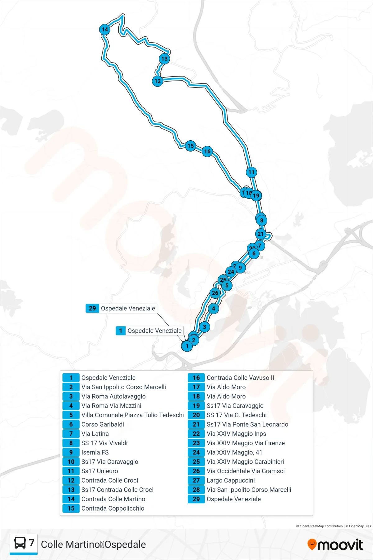
Stops list (7 - Colle Martino to Hospital)
- Veneziale Hospital
- San Ippolito Street Marcelli Avenue
- Via Roma Car Wash
- Via Roma Via Mazzini
- Public Park Tulio Tedeschi Square
- Garibaldi Street
- Latin Street
- SS 17 Vivaldi Street
- Isernia Station
- SS17 Via Caravaggio
- SS17 Unieuro
- Colle Croci District
- SS17 Colle Croci District
- Colle Martino District
- Coppolicchio District
- Colle Vavuso II District
- Aldo Moro Street
- Aldo Moro Street
- SS17 Via Caravaggio
- SS 17 Via G. Tedeschi
- Ss17 San Leonardo Bridge Road
- XXIV May Street Inps
- XXIV May Street Florence Street
- XXIV Maggio Street, 41
- XXIV May Street Carabinieri
- Western Street Via Gramsci
- Cappuccini Square
- San Ippolito Street Marcelli Avenue
- Veneziale Hospital