
7 Bus Route Map
View the 7 route map and see all 7 stops along the route. The map of 7 shows where the bus travels and the location of each stop, making it easy to understand the entire route at a glance.
Explore CTA routes on the map and see where CTA bus services operate. Use the 7 map to find bus stops and see how the 7 connects different areas along its trip.
All 7 stops on the map are displayed in route order, helping you follow the 7 bus from the first stop to the last.
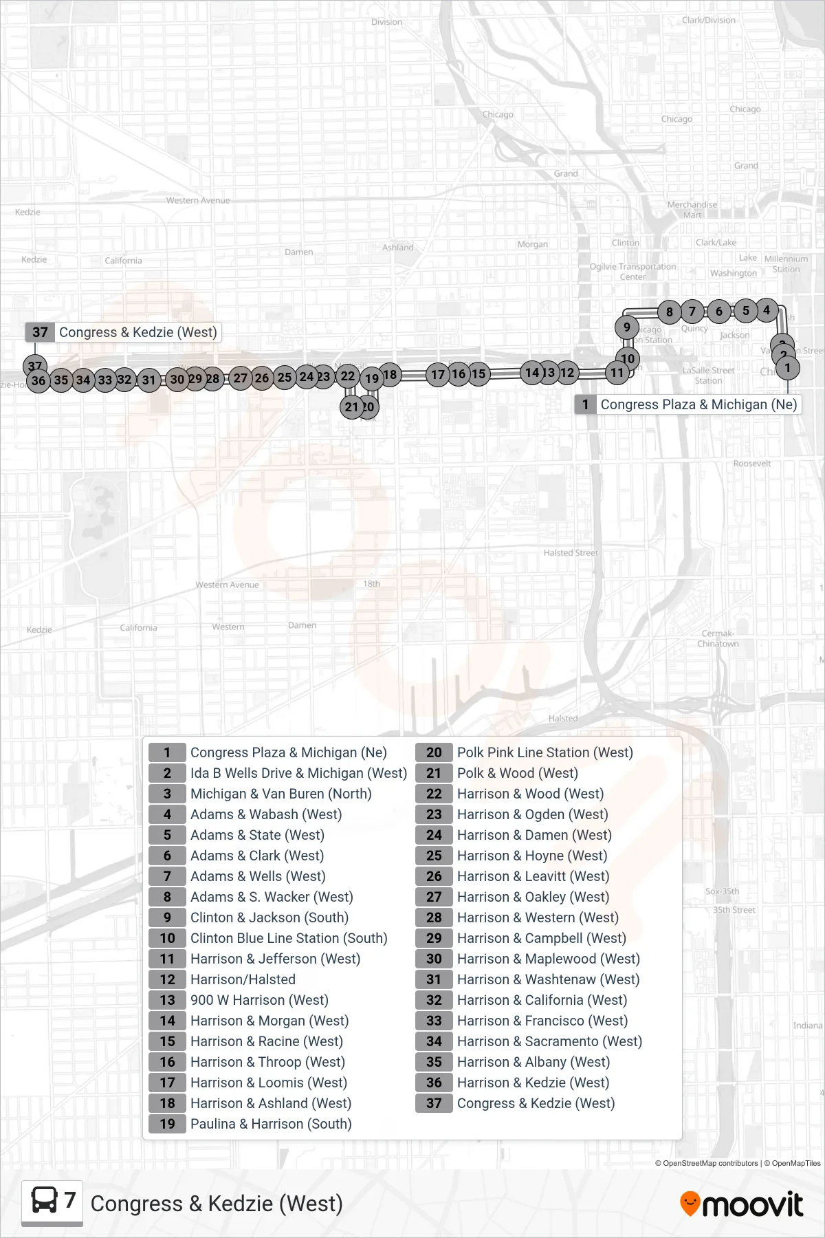
Stops list (7 - Congress & Kedzie (West))
- Congress Plaza & Michigan (Ne)
- Ida B Wells Drive & Michigan (West)
- Michigan & Van Buren (North)
- Adams & Wabash (West)
- Adams & State (West)
- Adams & Clark (West)
- Adams & Wells (West)
- Adams & S. Wacker (West)
- Clinton & Jackson (South)
- Clinton Blue Line Station (South)
- Harrison & Jefferson (West)
- Harrison/Halsted
- 900 W Harrison (West)
- Harrison & Morgan (West)
- Harrison & Racine (West)
- Harrison & Throop (West)
- Harrison & Loomis (West)
- Harrison & Ashland (West)
- Paulina & Harrison (South)
- Polk Pink Line Station (West)
- Polk & Wood (West)
- Harrison & Wood (West)
- Harrison & Ogden (West)
- Harrison & Damen (West)
- Harrison & Hoyne (West)
- Harrison & Leavitt (West)
- Harrison & Oakley (West)
- Harrison & Western (West)
- Harrison & Campbell (West)
- Harrison & Maplewood (West)
- Harrison & Washtenaw (West)
- Harrison & California (West)
- Harrison & Francisco (West)
- Harrison & Sacramento (West)
- Harrison & Albany (West)
- Harrison & Kedzie (West)
- Congress & Kedzie (West)