
7 Bus Route Map
View the 7 route map and see all 7 stops along the route. The map of 7 shows where the bus travels and the location of each stop, making it easy to understand the entire route at a glance.
Explore Livorno and Province - Tuscan Bus Lines routes on the map and see where Livorno and Province - Tuscan Bus Lines bus services operate. Use the 7 map to find bus stops and see how the 7 connects different areas along its trip.
All 7 stops on the map are displayed in route order, helping you follow the 7 bus from the first stop to the last.
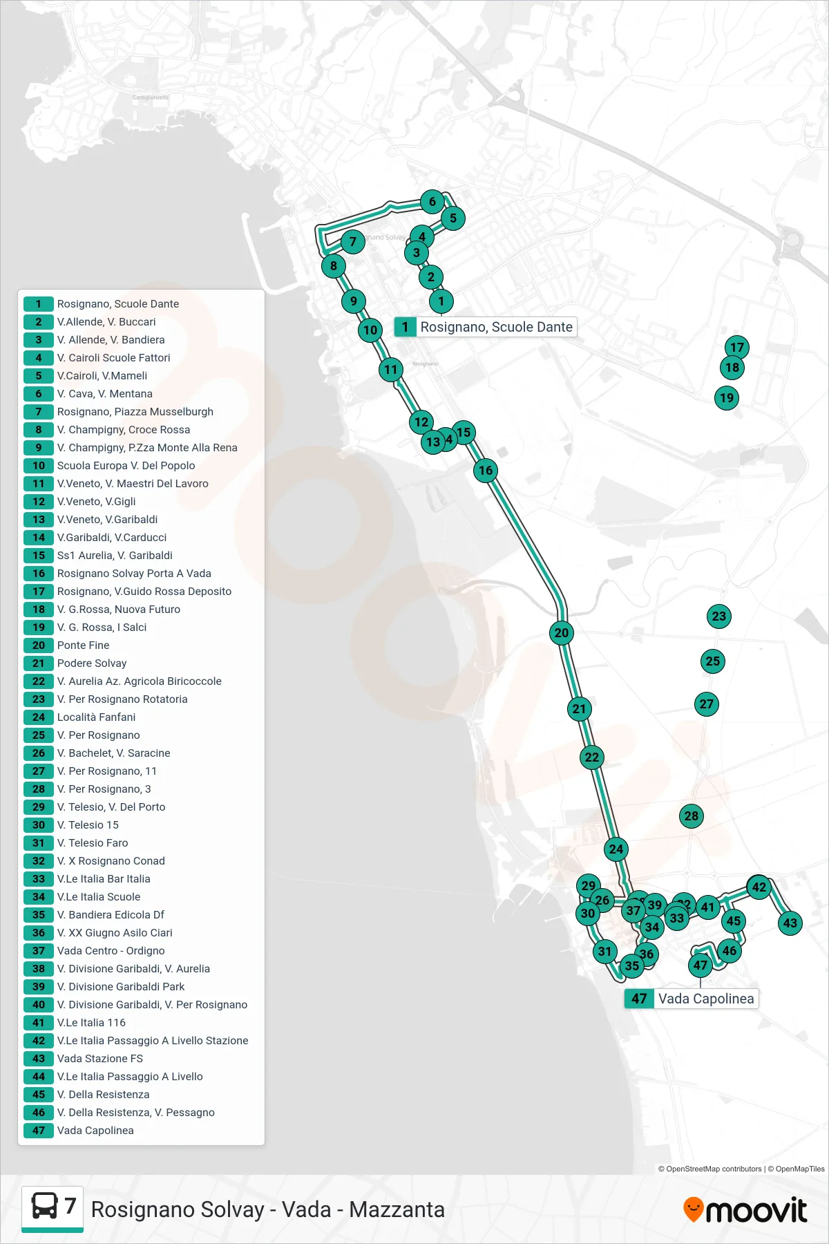
Stops list (7 - Vada Terminal)
- Rosignano, Dante Schools
- Allende St, Buccari St
- Allende Road, Bandiera Road
- V. Cairoli Fattori Schools
- Cairoli Street, Mameli Street
- Via Cava, Via Mentana
- Rosignano, Musselburgh Square
- Champigny Street, Red Cross
- V. Champigny, Monte Alla Rena Square
- Europa School Via Del Popolo
- Veneto Street, Workers Masters Street
- Veneto St, Gigli St
- Veneto St., Garibaldi St.
- Via Garibaldi, Via Carducci
- SS1 Aurelia, Garibaldi Street
- Rosignano Solvay Porta A Vada
- Rosignano, Guido Rossa Street Depot
- V. G.Rossa, Nuova Futuro
- Via G. Rossa, I Salci
- Ponte Fine
- Solvay Estate
- Aurelia Road Biricoccole Farm
- Rosignano Roundabout
- Fanfani Area
- Via Per Rosignano
- Via Bachelet, Via Saracine
- Rosignano Road, 11
- Road to Rosignano, 3
- Via Telesio, Via Del Porto
- Telesio St. 15
- Telesio Lighthouse Street
- Via X Rosignano Conad
- Italia Avenue Bar Italia
- Italia Avenue Schools
- Via Bandiera Newsstand
- XX June St - Ciari Kindergarten
- Vada Center - Ordigno
- Garibaldi Division St, Aurelia St
- Via Divisione Garibaldi Park
- Garibaldi Division Street, Rosignano Road
- Italia Avenue 116
- Italia Avenue Railway Level Crossing Station
- Vada Railway Station
- Italia Avenue Railroad Crossing
- Resistance Street
- Via Della Resistenza, Via Pessagno
- Vada Terminal