
7 Bus Route Map
View the 7 route map and see all 7 stops along the route. The map of 7 shows where the bus travels and the location of each stop, making it easy to understand the entire route at a glance.
Explore Green Bay Metro Transit routes on the map and see where Green Bay Metro Transit bus services operate. Use the 7 map to find bus stops and see how the 7 connects different areas along its trip.
All 7 stops on the map are displayed in route order, helping you follow the 7 bus from the first stop to the last.
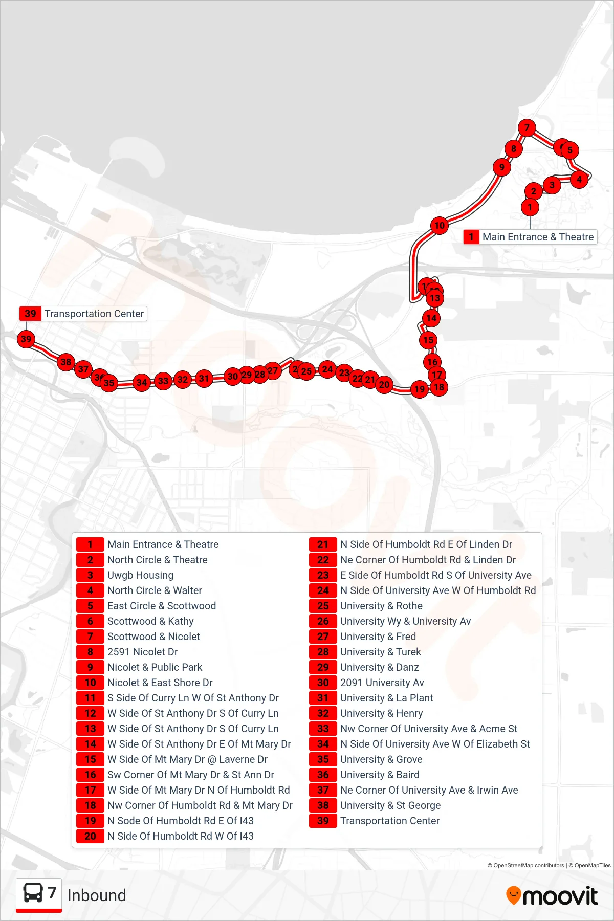
Stops list (7 - Inbound)
- Main Entrance & Theatre
- North Circle & Theatre
- Uwgb Housing
- North Circle & Walter
- East Circle & Scottwood
- Scottwood & Kathy
- Scottwood & Nicolet
- 2591 Nicolet Dr
- Nicolet & Public Park
- Nicolet & East Shore Dr
- S Side Of Curry Ln W Of St Anthony Dr
- W Side Of St Anthony Dr S Of Curry Ln
- W Side Of St Anthony Dr S Of Curry Ln
- W Side Of St Anthony Dr E Of Mt Mary Dr
- W Side Of Mt Mary Dr @ Laverne Dr
- Sw Corner Of Mt Mary Dr & St Ann Dr
- W Side Of Mt Mary Dr N Of Humboldt Rd
- Nw Corner Of Humboldt Rd & Mt Mary Dr
- N Sode Of Humboldt Rd E Of I43
- N Side Of Humboldt Rd W Of I43
- N Side Of Humboldt Rd E Of Linden Dr
- Ne Corner Of Humboldt Rd & Linden Dr
- E Side Of Humboldt Rd S Of University Ave
- N Side Of University Ave W Of Humboldt Rd
- University & Rothe
- University Wy & University Av
- University & Fred
- University & Turek
- University & Danz
- 2091 University Av
- University & La Plant
- University & Henry
- Nw Corner Of University Ave & Acme St
- N Side Of University Ave W Of Elizabeth St
- University & Grove
- University & Baird
- Ne Corner Of University Ave & Irwin Ave
- University & St George
- Transportation Center