
7 Cable Car Route Map
View the 7 route map and see all 7 stops along the route. The map of 7 shows where the cable car travels and the location of each stop, making it easy to understand the entire route at a glance.
Explore KP Kyivpastrans routes on the map and see where KP Kyivpastrans cable car services operate. Use the 7 map to find cable car stations and see how the 7 connects different areas along its trip.
All 7 stops on the map are displayed in route order, helping you follow the 7 cable car from the first station to the last.
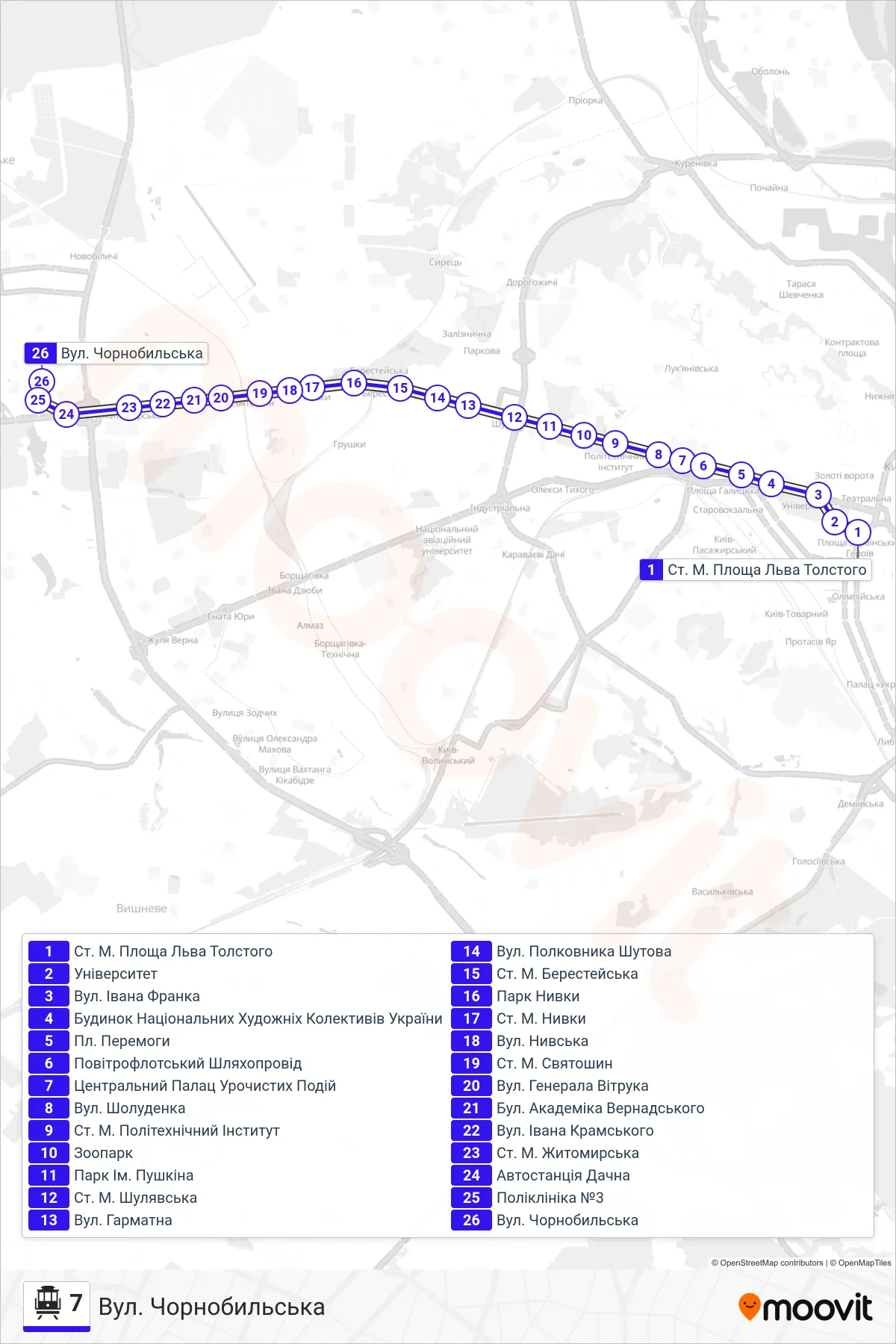
Stops list (7 - Chornobylska St.)
- Tolstoy Square Metro Station
- University
- Ivan Franko St
- House of National Art Collectives of Ukraine
- Victory Square
- Povitroflotskyi Overpass
- Central Palace of Ceremonial Events
- Sholudenka Street
- Metro Station Polytechnic Institute
- Zoo
- Pushkin Park
- Shuliavska Metro Station
- Harmatna Street
- Colonel Shutov Street
- Beresteiska Metro Station
- Nyvky Park
- Nyvky Metro Station
- Nyvska St
- Sviatoshyn Metro Station
- General Vitruk Street
- Academician Vernadsky Boulevard
- Ivan Kramskyi Street
- Zhytomyrska Metro Station
- Dachna Bus Station
- Polyclinic No. 3
- Chornobylska St.