
7 Bus Route Map
View the 7 route map and see all 7 stops along the route. The map of 7 shows where the bus travels and the location of each stop, making it easy to understand the entire route at a glance.
Explore RhönEnergie Bus GmbH routes on the map and see where RhönEnergie Bus GmbH bus services operate. Use the 7 map to find bus stops and see how the 7 connects different areas along its trip.
All 7 stops on the map are displayed in route order, helping you follow the 7 bus from the first stop to the last.
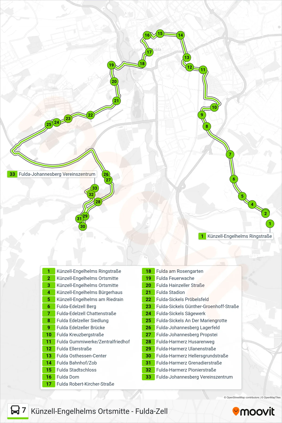
Stops list (7 - Johannesberg)
- Künzell-Engelhelms Ringstraße
- Künzell-Engelhelms Ortsmitte
- Künzell-Engelhelms Ortsmitte
- Künzell-Engelhelms Bürgerhaus
- Künzell-Engelhelms am Riedrain
- Fulda-Edelzell Berg
- Fulda-Edelzell Chattenstraße
- Fulda Edelzeller Siedlung
- Fulda Edelzeller Brücke
- Fulda Kreuzbergstraße
- Fulda Gummiwerke/Zentralfriedhof
- Fulda Ellerstraße
- Fulda Osthessen-Center
- Fulda Bahnhof/Zob
- Fulda Stadtschloss
- Fulda Dom
- Fulda Robert-Kircher-Straße
- Fulda am Rosengarten
- Fulda Feuerwache
- Fulda Hainzeller Straße
- Fulda Stadion
- Fulda-Sickels Pröbelsfeld
- Fulda-Sickels Günther-Groenhoff-Straße
- Fulda-Sickels Sägewerk
- Fulda-Sickels An Der Mariengrotte
- Fulda-Johannesberg Lagerfeld
- Fulda-Johannesberg Propstei
- Fulda-Harmerz Husarenweg
- Fulda-Harmerz Ulanenstraße
- Fulda-Harmerz Hellersgrundstraße
- Fulda-Harmerz Grenadierstraße
- Fulda-Harmerz Pionierstraße
- Fulda-Johannesberg Vereinszentrum