
7 Bus Route Map
View the 7 route map and see all 7 stops along the route. The map of 7 shows where the bus travels and the location of each stop, making it easy to understand the entire route at a glance.
Explore U-OV routes on the map and see where U-OV bus services operate. Use the 7 map to find bus stops and see how the 7 connects different areas along its trip.
All 7 stops on the map are displayed in route order, helping you follow the 7 bus from the first stop to the last.
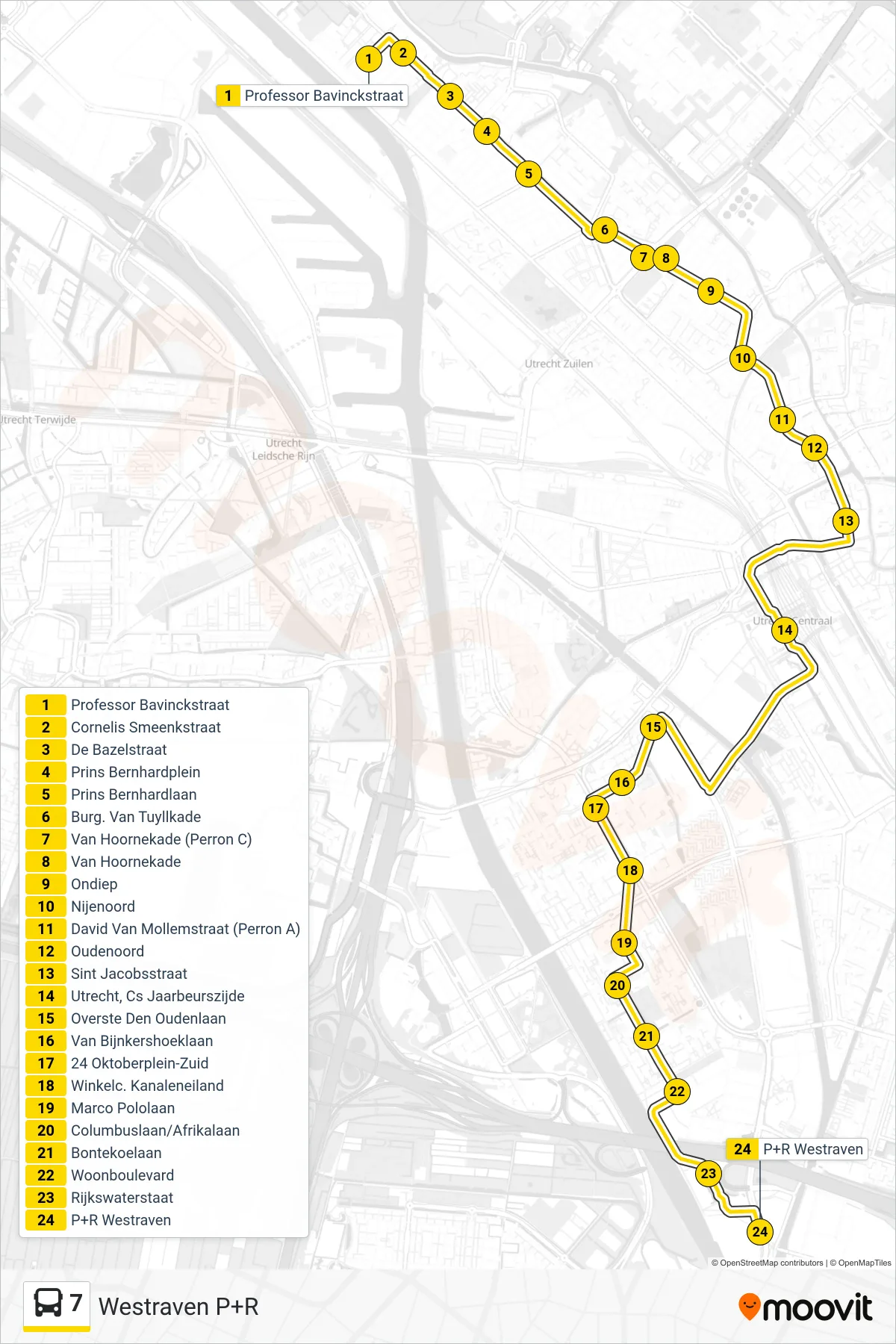
Stops list (7 - Westraven P+R)
- Professor Bavinckstraat
- Cornelis Smeenkstraat
- De Bazelstraat
- Prins Bernhardplein
- Prins Bernhardlaan
- Burg. Van Tuyllkade
- Van Hoornekade (Perron C)
- Van Hoornekade
- Ondiep
- Nijenoord
- David Van Mollemstraat (Perron A)
- Oudenoord
- Sint Jacobsstraat
- Utrecht, Cs Jaarbeurszijde
- Overste Den Oudenlaan
- Van Bijnkershoeklaan
- 24 Oktoberplein-Zuid
- Winkelc. Kanaleneiland
- Marco Pololaan
- Columbuslaan/Afrikalaan
- Bontekoelaan
- Woonboulevard
- Rijkswaterstaat
- P+R Westraven