
7 Tram Route Map
View the 7 route map and see all 7 stops along the route. The map of 7 shows where the tram travels and the location of each stop, making it easy to understand the entire route at a glance.
Explore Rīgas satiksme routes on the map and see where Rīgas satiksme tram services operate. Use the 7 map to find tram stations and see how the 7 connects different areas along its trip.
All 7 stops on the map are displayed in route order, helping you follow the 7 tram from the first station to the last.
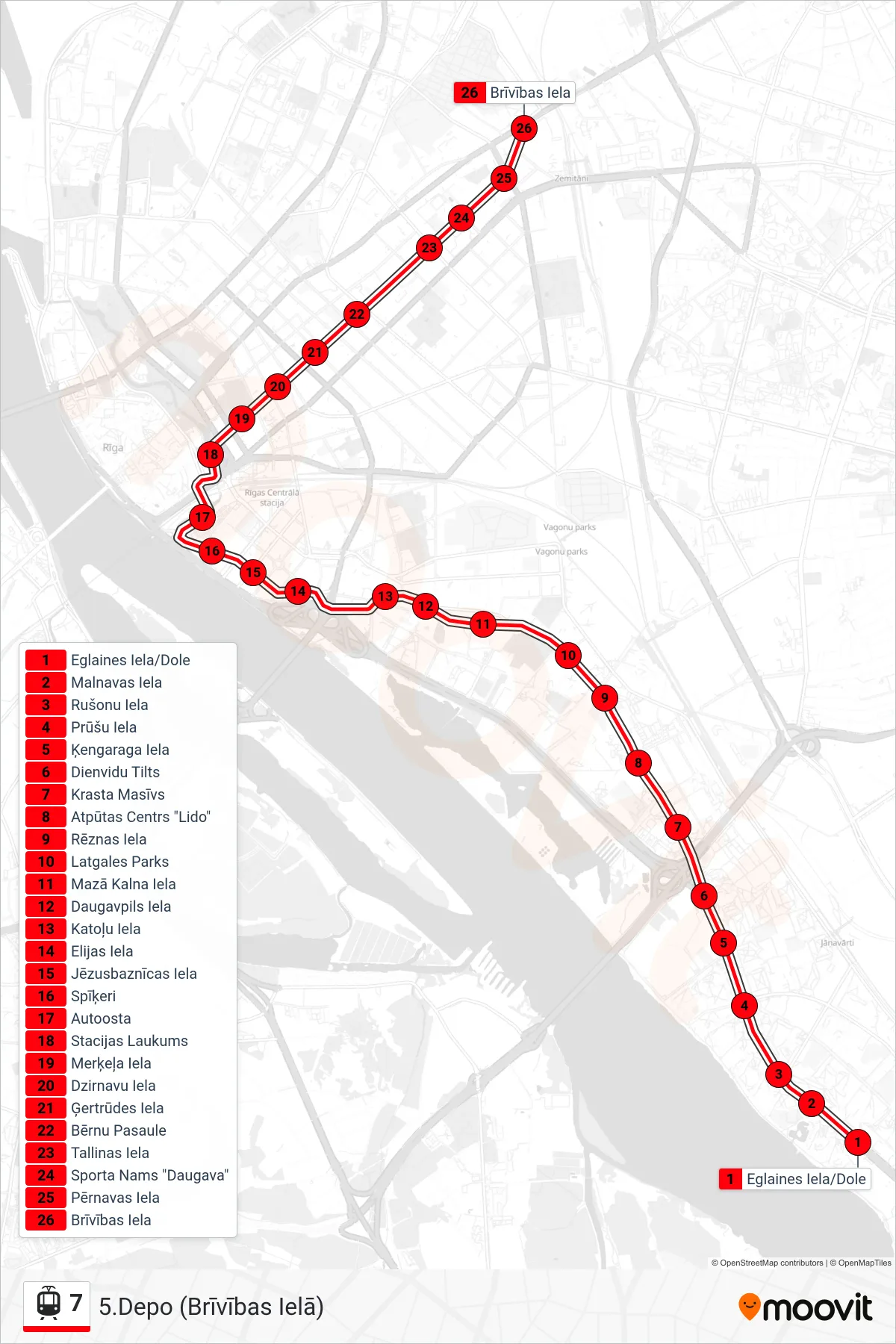
Stops list (7 - 5.Depo (Brīvības Ielā))
- Eglaines Iela/Dole
- Malnavas Iela
- Rušonu Iela
- Prūšu Iela
- Ķengaraga Iela
- Dienvidu Tilts
- Krasta Masīvs
- Atpūtas Centrs "Lido"
- Rēznas Iela
- Latgales Parks
- Mazā Kalna Iela
- Daugavpils Iela
- Katoļu Iela
- Elijas Iela
- Jēzusbaznīcas Iela
- Spīķeri
- Autoosta
- Stacijas Laukums
- Merķeļa Iela
- Dzirnavu Iela
- Ģertrūdes Iela
- Bērnu Pasaule
- Tallinas Iela
- Sporta Nams "Daugava"
- Pērnavas Iela
- Brīvības Iela