
7 Bus Route Map
View the 7 route map and see all 7 stops along the route. The map of 7 shows where the bus travels and the location of each stop, making it easy to understand the entire route at a glance.
Explore GoCary routes on the map and see where GoCary bus services operate. Use the 7 map to find bus stops and see how the 7 connects different areas along its trip.
All 7 stops on the map are displayed in route order, helping you follow the 7 bus from the first stop to the last.
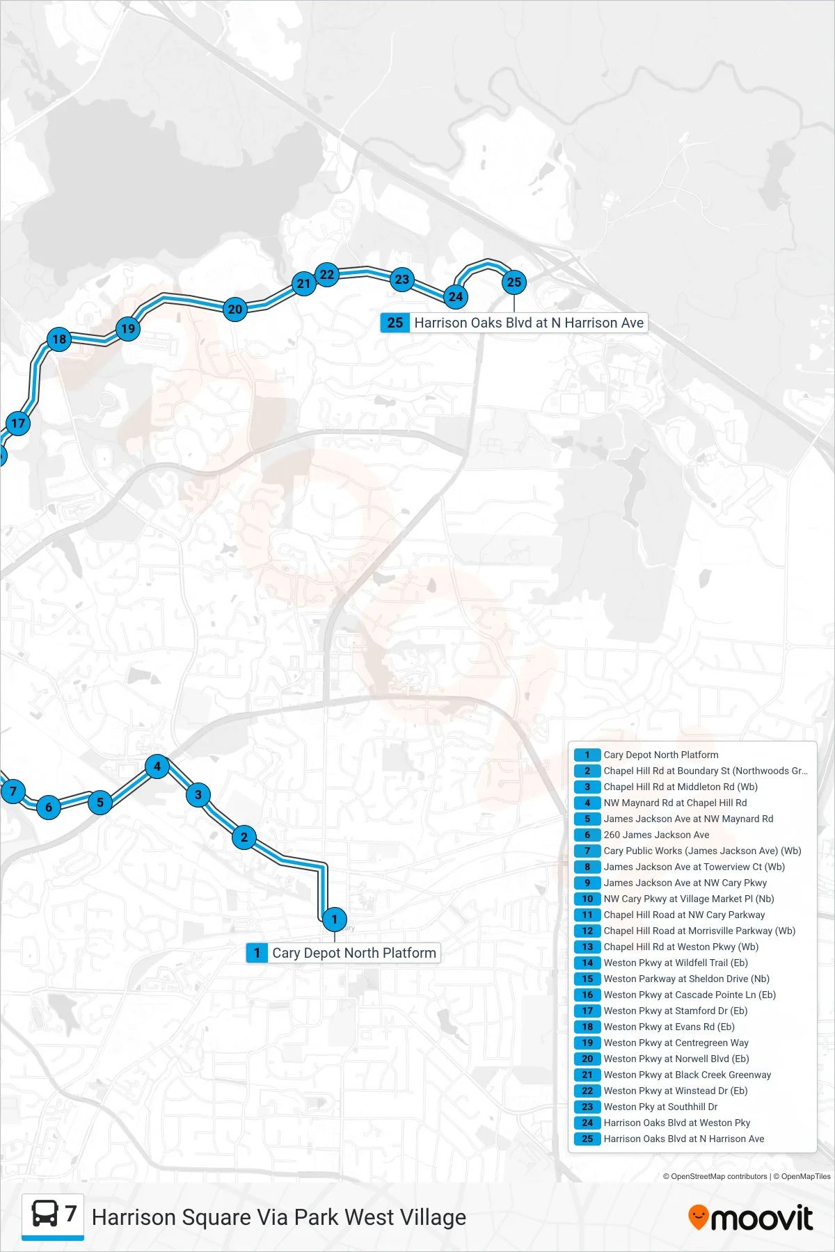
Stops list (7 - Harrison Square Via Park West Village)
- Cary Depot North Platform
- Chapel Hill Rd at Boundary St (Northwoods Greenway) (Wb)
- Chapel Hill Rd at Middleton Rd (Wb)
- NW Maynard Rd at Chapel Hill Rd
- James Jackson Ave at NW Maynard Rd
- 260 James Jackson Ave
- Cary Public Works (James Jackson Ave) (Wb)
- James Jackson Ave at Towerview Ct (Wb)
- James Jackson Ave at NW Cary Pkwy
- NW Cary Pkwy at Village Market Pl (Nb)
- Chapel Hill Road at NW Cary Parkway
- Chapel Hill Road at Morrisville Parkway (Wb)
- Chapel Hill Rd at Weston Pkwy (Wb)
- Weston Pkwy at Wildfell Trail (Eb)
- Weston Parkway at Sheldon Drive (Nb)
- Weston Pkwy at Cascade Pointe Ln (Eb)
- Weston Pkwy at Stamford Dr (Eb)
- Weston Pkwy at Evans Rd (Eb)
- Weston Pkwy at Centregreen Way
- Weston Pkwy at Norwell Blvd (Eb)
- Weston Pkwy at Black Creek Greenway
- Weston Pkwy at Winstead Dr (Eb)
- Weston Pky at Southhill Dr
- Harrison Oaks Blvd at Weston Pky
- Harrison Oaks Blvd at N Harrison Ave