
7 Bus Route Map
View the 7 route map and see all 7 stops along the route. The map of 7 shows where the bus travels and the location of each stop, making it easy to understand the entire route at a glance.
Explore GoDurham routes on the map and see where GoDurham bus services operate. Use the 7 map to find bus stops and see how the 7 connects different areas along its trip.
All 7 stops on the map are displayed in route order, helping you follow the 7 bus from the first stop to the last.
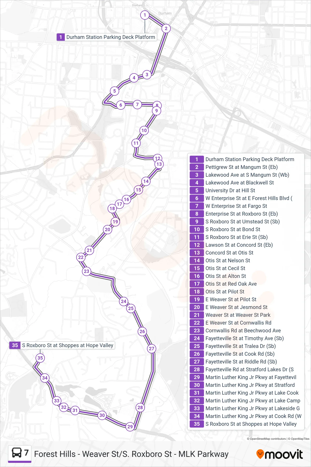
Stops list (7 - 7: S. Roxboro)
- Durham Station Parking Deck Platform
- Pettigrew St at Mangum St (Eb)
- Lakewood Ave at S Mangum St (Wb)
- Lakewood Ave at Blackwell St
- University Dr at Hill St
- W Enterprise St at E Forest Hills Blvd (
- W Enterprise St at Fargo St
- Enterprise St at Roxboro St (Eb)
- S Roxboro St at Umstead St (Sb)
- S Roxboro St at Bond St
- S Roxboro St at Erie St (Sb)
- Lawson St at Concord St (Eb)
- Concord St at Otis St
- Otis St at Nelson St
- Otis St at Cecil St
- Otis St at Alton St
- Otis St at Red Oak Ave
- Otis St at Pilot St
- E Weaver St at Pilot St
- E Weaver St at Jesmond St
- Weaver St at Weaver St Park
- E Weaver St at Cornwallis Rd
- Cornwallis Rd at Beechwood Ave
- Fayetteville St at Timothy Ave (Sb)
- Fayetteville St at Tralea Dr (Sb)
- Fayetteville St at Cook Rd (Sb)
- Fayetteville St at Riddle Rd (Sb)
- Fayetteville Rd at Stratford Lakes Dr (S
- Martin Luther King Jr Pkwy at Fayettevil
- Martin Luther King Jr Pkwy at Stratford
- Martin Luther King Jr Pkwy at Lake Cook
- Martin Luther King Jr Pkwy at Lake Camp
- Martin Luther King Jr Pkwy at Lakeside G
- Martin Luther King Jr Pkwy at Cook Rd (W
- S Roxboro St at Shoppes at Hope Valley