
7 Bus Route Map
View the 7 route map and see all 7 stops along the route. The map of 7 shows where the bus travels and the location of each stop, making it easy to understand the entire route at a glance.
Explore RTC RIDE routes on the map and see where RTC RIDE bus services operate. Use the 7 map to find bus stops and see how the 7 connects different areas along its trip.
All 7 stops on the map are displayed in route order, helping you follow the 7 bus from the first stop to the last.
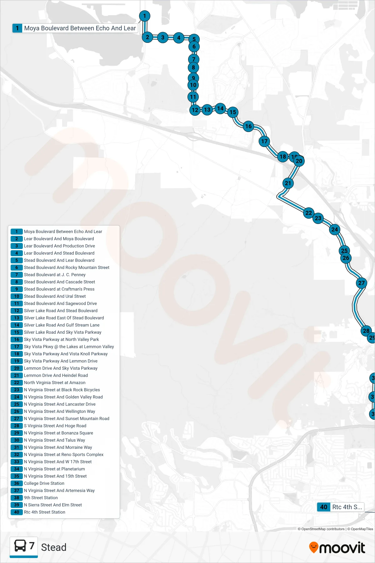
Stops list (7 - Rtc 4th Street Station)
- Moya Boulevard Between Echo And Lear
- Lear Boulevard And Moya Boulevard
- Lear Boulevard And Production Drive
- Lear Boulevard And Stead Boulevard
- Stead Boulevard And Lear Boulevard
- Stead Boulevard And Rocky Mountain Street
- Stead Boulevard at J. C. Penney
- Stead Boulevard And Cascade Street
- Stead Boulevard at Craftman's Press
- Stead Boulevard And Ural Street
- Stead Boulevard And Sagewood Drive
- Silver Lake Road And Stead Boulevard
- Silver Lake Road East Of Stead Boulevard
- Silver Lake Road And Gulf Stream Lane
- Silver Lake Road And Sky Vista Parkway
- Sky Vista Parkway at North Valley Park
- Sky Vista Pkwy @ the Lakes at Lemmon Valley
- Sky Vista Parkway And Vista Knoll Parkway
- Sky Vista Parkway And Lemmon Drive
- Lemmon Drive And Sky Vista Parkway
- Lemmon Drive And Heindel Road
- North Virginia Street at Amazon
- N Virginia Street at Black Rock Bicycles
- N Virginia Street And Golden Valley Road
- N Virginia Street And Lancaster Drive
- N Virginia Street And Wellington Way
- N Virginia Street And Sunset Mountain Road
- S Virginia Street And Hoge Road
- N Virginia Street at Bonanza Square
- N Virginia Street And Talus Way
- N Virginia Street And Morraine Way
- N Virginia Street at Reno Sports Complex
- N Virginia Street And W 17th Street
- N Virginia Street at Planetarium
- N Virginia Street And 15th Street
- College Drive Station
- N Virginia Street And Artemesia Way
- 9th Street Station
- N Sierra Street And Elm Street
- Rtc 4th Street Station