
7 Tram Route Map
View the 7 route map and see all 7 stops along the route. The map of 7 shows where the tram travels and the location of each stop, making it easy to understand the entire route at a glance.
Explore routes on the map and see where tram services operate. Use the 7 map to find tram stations and see how the 7 connects different areas along its trip.
All 7 stops on the map are displayed in route order, helping you follow the 7 tram from the first station to the last.
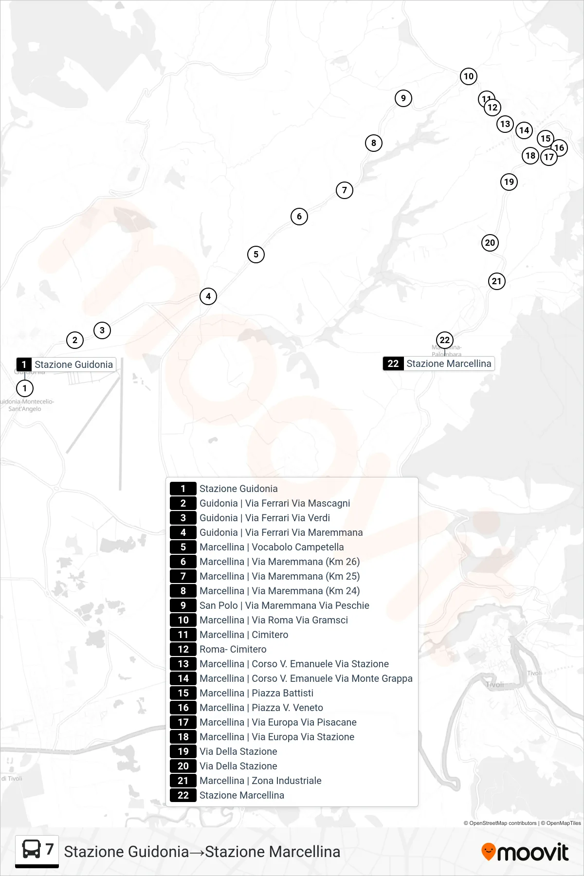
Stops list (7 - Marcellina Station)
- Guidonia Station
- Guidonia | Ferrari Street Mascagni Street
- Guidonia - Via Ferrari Via Verdi
- Guidonia | Ferrari Road Maremmana Road
- Marcellina | Campetella Area
- Marcellina - Via Maremmana (Km 26)
- Marcellina | Maremmana Road (Km 25)
- Marcellina | Maremmana Road (Km 24)
- San Polo | Maremmana Road Peschie Road
- Marcellina | Roma Street Gramsci Street
- Marcellina | Cemetery
- Rome Cemetery
- Marcellina | Corso V. Emanuele Station Road
- Marcellina | Vittorio Emanuele Course Monte Grappa Street
- Marcellina | Battisti Square
- Marcellina - Piazza V. Veneto
- Marcellina | Europa Street Pisacane Street
- Marcellina | Europe Street Station Street
- Station Street
- Station Street
- Marcellina | Industrial Zone
- Marcellina Station