
7 Bus Route Map
View the 7 route map and see all 7 stops along the route. The map of 7 shows where the bus travels and the location of each stop, making it easy to understand the entire route at a glance.
Explore Cooperative Alliance for Seacoast Transportation routes on the map and see where Cooperative Alliance for Seacoast Transportation bus services operate. Use the 7 map to find bus stops and see how the 7 connects different areas along its trip.
All 7 stops on the map are displayed in route order, helping you follow the 7 bus from the first stop to the last.
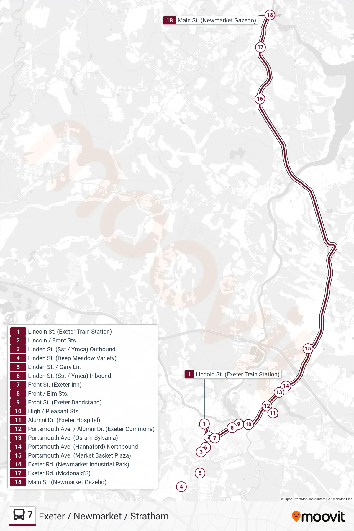
Stops list (7 - Northbound)
- Lincoln St. (Exeter Train Station)
- Lincoln / Front Sts.
- Linden St. (Sst / Ymca) Outbound
- Linden St. (Deep Meadow Variety)
- Linden St. / Gary Ln.
- Linden St. (Sst / Ymca) Inbound
- Front St. (Exeter Inn)
- Front / Elm Sts.
- Front St. (Exeter Bandstand)
- High / Pleasant Sts.
- Alumni Dr. (Exeter Hospital)
- Portsmouth Ave. / Alumni Dr. (Exeter Commons)
- Portsmouth Ave. (Osram-Sylvania)
- Portsmouth Ave. (Hannaford) Northbound
- Portsmouth Ave. (Market Basket Plaza)
- Exeter Rd. (Newmarket Industrial Park)
- Exeter Rd. (Mcdonald'S)
- Main St. (Newmarket Gazebo)