
7 Light Rail Route Map
View the 7 route map and see all 7 stops along the route. The map of 7 shows where the light rail travels and the location of each stop, making it easy to understand the entire route at a glance.
Explore Rhein-Neckar-Verkehr GmbH (rnv) routes on the map and see where Rhein-Neckar-Verkehr GmbH (rnv) light rail services operate. Use the 7 map to find light rail stations and see how the 7 connects different areas along its trip.
All 7 stops on the map are displayed in route order, helping you follow the 7 light rail from the first station to the last.
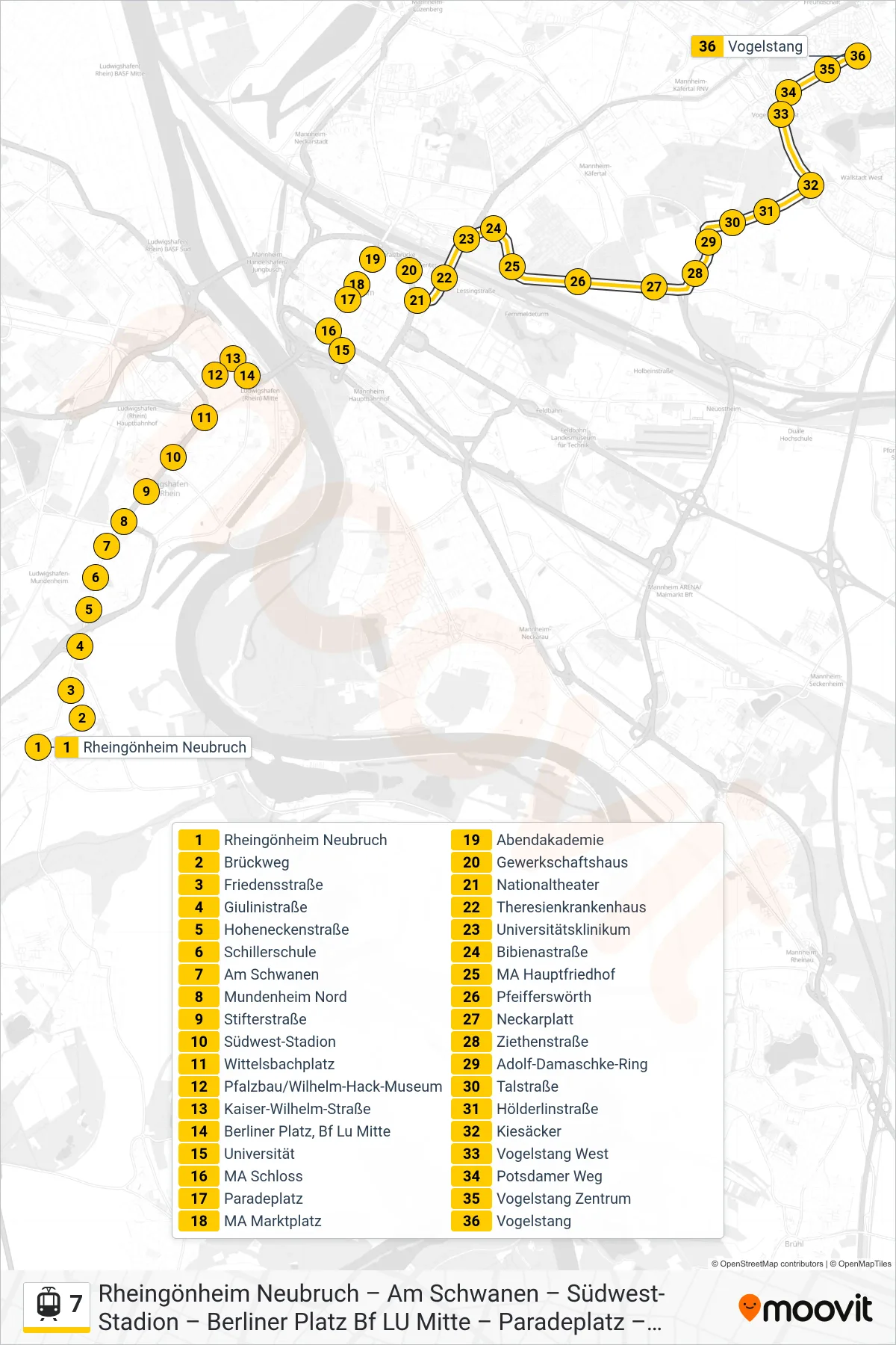
Stops list (7 - Vogelstang)
- Rheingönheim Neubruch
- Brückweg
- Friedensstraße
- Giulinistraße
- Hoheneckenstraße
- Schillerschule
- Am Schwanen
- Mundenheim Nord
- Stifterstraße
- Südwest-Stadion
- Wittelsbachplatz
- Pfalzbau/Wilhelm-Hack-Museum
- Kaiser-Wilhelm-Straße
- Berliner Platz, Bf Lu Mitte
- Universität
- MA Schloss
- Paradeplatz
- MA Marktplatz
- Abendakademie
- Gewerkschaftshaus
- Nationaltheater
- Theresienkrankenhaus
- Universitätsklinikum
- Bibienastraße
- MA Hauptfriedhof
- Pfeifferswörth
- Neckarplatt
- Ziethenstraße
- Adolf-Damaschke-Ring
- Talstraße
- Hölderlinstraße
- Kiesäcker
- Vogelstang West
- Potsdamer Weg
- Vogelstang Zentrum
- Vogelstang