
7 Bus Route Map
View the 7 route map and see all 7 stops along the route. The map of 7 shows where the bus travels and the location of each stop, making it easy to understand the entire route at a glance.
Explore Asp Asti routes on the map and see where Asp Asti bus services operate. Use the 7 map to find bus stops and see how the 7 connects different areas along its trip.
All 7 stops on the map are displayed in route order, helping you follow the 7 bus from the first stop to the last.
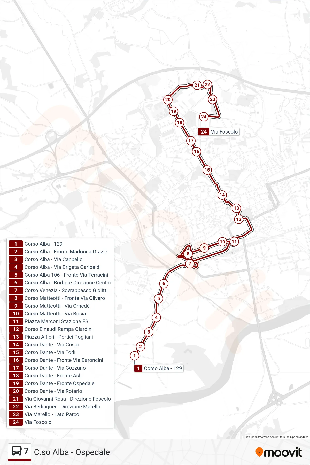
Stops list (7 - Hospital Zone - Via Foscolo)
- Alba Avenue - 129
- Alba Avenue - Opposite Madonna Grazie
- Alba Avenue - Cappello Street
- Alba Avenue - Garibaldi Brigade Street
- Alba Course 106 - Across Terracini Street
- Alba Course - Borbore Direction Center
- Venice Course - Giolitti Overpass
- Matteotti Course - Opposite Olivero Street
- Matteotti Avenue - Omede Street
- Matteotti Avenue - Bosia Street
- Marconi Square FS Station
- Einaudi Avenue Garden Ramp
- Alfieri Square - Pogliani Arcade
- Dante Avenue - Crispi Street
- Dante Avenue - Todi Street
- Dante Avenue - Opposite Baroncini Street
- Dante Avenue - Via Gozzano
- Corso Dante - Across from Health Center
- Dante Avenue - Hospital Front
- Corso Dante - Via Rotario
- Via Giovanni Rosa - Towards Foscolo
- Berlinguer Street - Marello Direction
- Marello Street - Park Side
- Foscolo Street