
7 Bus Route Map
View the 7 route map and see all 7 stops along the route. The map of 7 shows where the bus travels and the location of each stop, making it easy to understand the entire route at a glance.
Explore Salzburg AG (OBus) routes on the map and see where Salzburg AG (OBus) bus services operate. Use the 7 map to find bus stops and see how the 7 connects different areas along its trip.
All 7 stops on the map are displayed in route order, helping you follow the 7 bus from the first stop to the last.
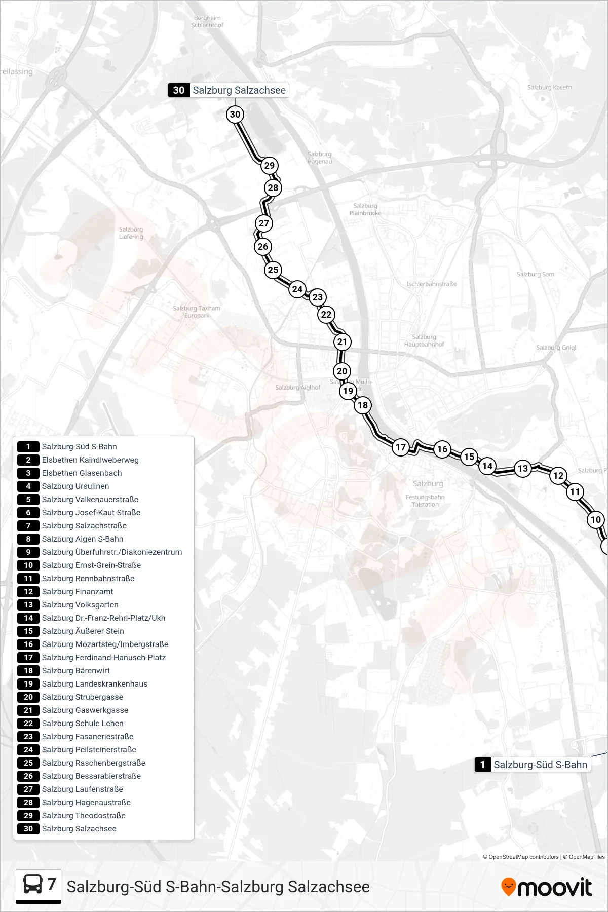
Stops list (7 - Salzachsee)
- Salzburg-Süd S-Bahn
- Elsbethen Kaindlweberweg
- Elsbethen Glasenbach
- Salzburg Ursulinen
- Salzburg Valkenauerstraße
- Salzburg Josef-Kaut-Straße
- Salzburg Salzachstraße
- Salzburg Aigen S-Bahn
- Salzburg Überfuhrstr./Diakoniezentrum
- Salzburg Ernst-Grein-Straße
- Salzburg Rennbahnstraße
- Salzburg Finanzamt
- Salzburg Volksgarten
- Salzburg Dr.-Franz-Rehrl-Platz/Ukh
- Salzburg Äußerer Stein
- Salzburg Mozartsteg/Imbergstraße
- Salzburg Ferdinand-Hanusch-Platz
- Salzburg Bärenwirt
- Salzburg Landeskrankenhaus
- Salzburg Strubergasse
- Salzburg Gaswerkgasse
- Salzburg Schule Lehen
- Salzburg Fasaneriestraße
- Salzburg Peilsteinerstraße
- Salzburg Raschenbergstraße
- Salzburg Bessarabierstraße
- Salzburg Laufenstraße
- Salzburg Hagenaustraße
- Salzburg Theodostraße
- Salzburg Salzachsee