
70 Bus Route Map
View the 70 route map and see all 70 stops along the route. The map of 70 shows where the bus travels and the location of each stop, making it easy to understand the entire route at a glance.
Explore De Lijn routes on the map and see where De Lijn bus services operate. Use the 70 map to find bus stops and see how the 70 connects different areas along its trip.
All 70 stops on the map are displayed in route order, helping you follow the 70 bus from the first stop to the last.
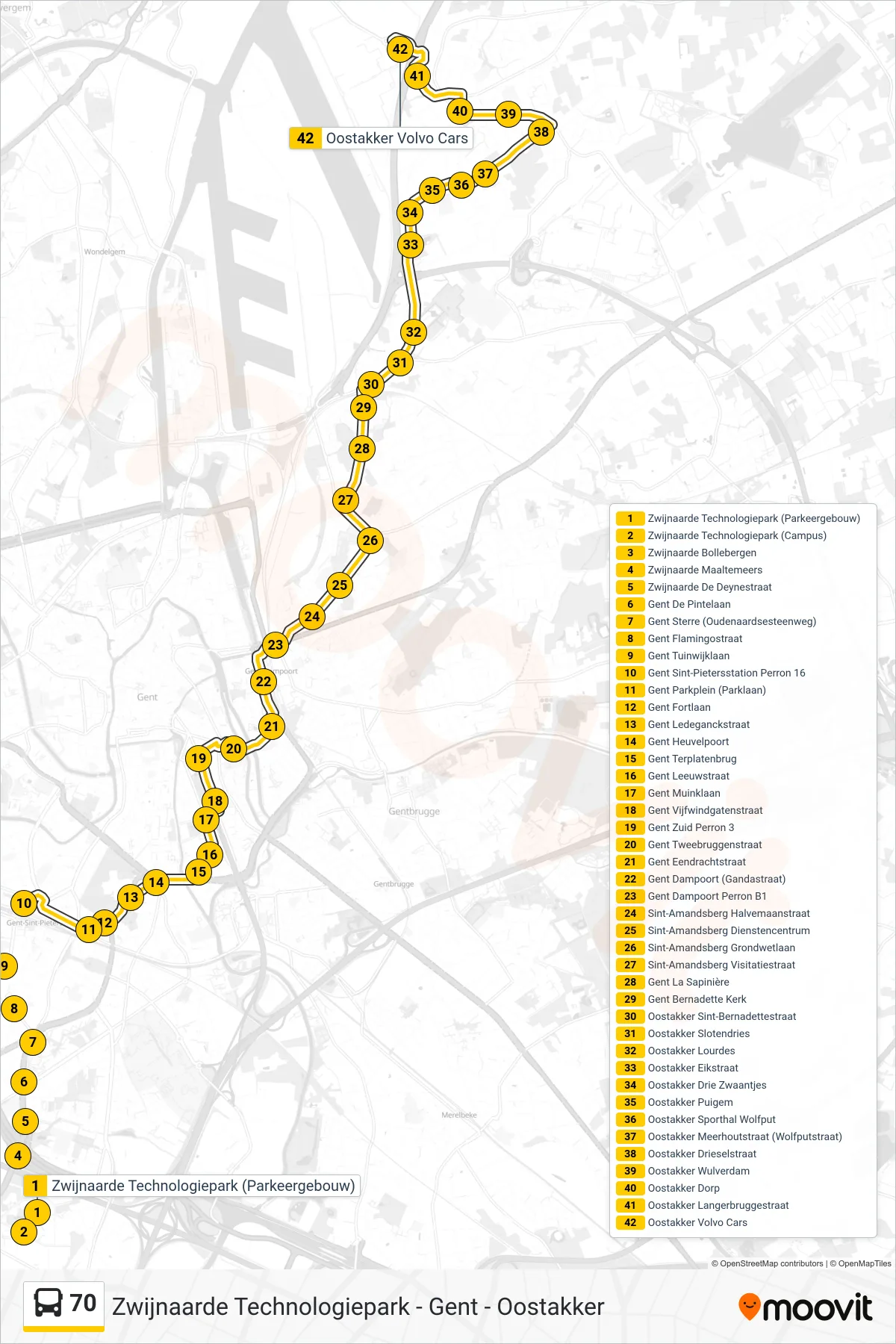
Stops list (70 - Oostakker Volvo Cars)
- Zwijnaarde Technology Park (Parking Building)
- Zwijnaarde Technology Park (Campus)
- Zwijnaarde Bollebergen
- Zwijnaarde Maaltemeers
- Zwijnaarde De Deyne Street
- Ghent De Pintelaan
- Ghent Star (Oudenaarde Road)
- Ghent Flamingo Street
- Ghent Garden District Avenue
- Ghent St Peters Station Platform 16
- Ghent Park Square (Park Avenue)
- Ghent Fort Avenue
- Ghent Ledeganck Street
- Ghent Hill Gate
- Ghent Terplaten Bridge
- Ghent Leeuw Street
- Ghent Muink Avenue
- Ghent Vijfwindgate Street
- Ghent South Platform 3
- Ghent Two Bridges Street
- Ghent Unity Street
- Ghent Dampoort (Gandastraat)
- Ghent Dampoort Platform B1
- Sint-Amandsberg Halfmoon Street
- Sint-Amandsberg Service Center
- Sint-Amandsberg Constitution Avenue
- Sint-Amandsberg Visitation Street
- Ghent The Pine Grove
- Ghent Bernadette Church
- Oostakker St. Bernadette Street
- Oostakker Slotendries
- Oostakker Lourdes
- Oostakker Oak Street
- Oostakker Three Swans
- Oostakker Puigem
- Oostakker Sports Hall Wolfput
- Oostakker Meerhout Street (Wolfput Street)
- Oostakker Driesel Street
- Oostakker Wulverdam
- Oostakker Village
- Oostakker Langerbrugge Street
- Oostakker Volvo Cars