
70 Bus Route Map
View the 70 route map and see all 70 stops along the route. The map of 70 shows where the bus travels and the location of each stop, making it easy to understand the entire route at a glance.
Explore De Lijn routes on the map and see where De Lijn bus services operate. Use the 70 map to find bus stops and see how the 70 connects different areas along its trip.
All 70 stops on the map are displayed in route order, helping you follow the 70 bus from the first stop to the last.
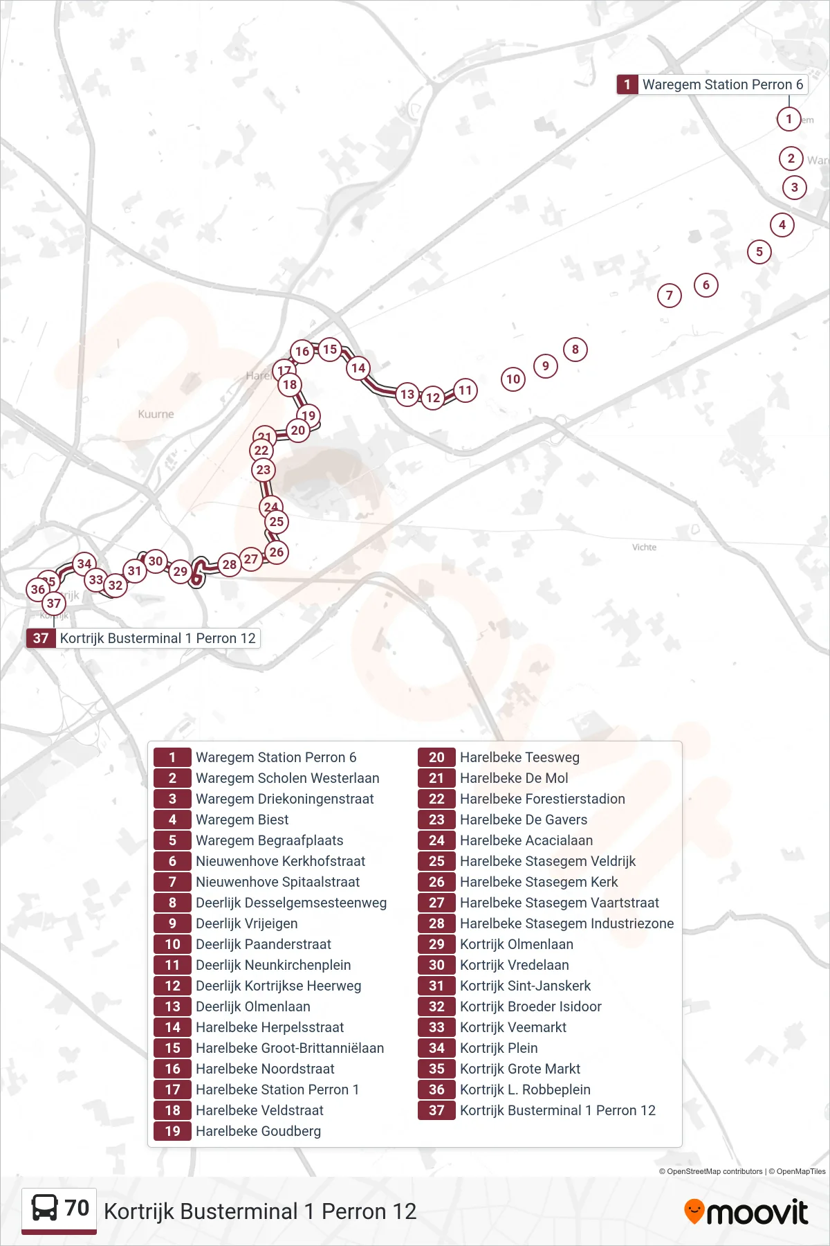
Stops list (70 - Kortrijk Bus Terminal 1 Platform 12)
- Waregem Station Platform 6
- Waregem Schools West Avenue
- Waregem Three Kings Street
- Waregem Biest
- Waregem Cemetery
- Nieuwenhove Kerkhofstraat
- Nieuwenhove Spitaalstraat
- Deerlijk Desselgem Road
- Vrijeigen Deerlijk
- Deerlijk Paander Street
- Deerlijk Neunkirchen Square
- Deerlijk Kortrijk Highway
- Deerlijk Elm Avenue
- Harelbeke Herpels Street
- Harelbeke Great Britain Avenue
- Harelbeke North Street
- Harelbeke Station Platform 1
- Harelbeke Field Street
- Harelbeke Goldhill
- Harelbeke Tees Way
- Harelbeke De Mol
- Harelbeke Forestier Stadium
- Harelbeke The Gavers
- Harelbeke Acacia Avenue
- Harelbeke Stasegem Veldrijk
- Harelbeke Stasegem Church
- Harelbeke Stasegem Canal Street
- Harelbeke Stasegem Industrial Zone
- Kortrijk Elm Avenue
- Kortrijk Peace Avenue
- Kortrijk St. John's Church
- Kortrijk Brother Isidoor
- Kortrijk Cattle Market
- Kortrijk Square
- Kortrijk Grand Market
- Kortrijk L. Robbeplein
- Kortrijk Bus Terminal 1 Platform 12