
70 Bus Route Map
View the 70 route map and see all 70 stops along the route. The map of 70 shows where the bus travels and the location of each stop, making it easy to understand the entire route at a glance.
Explore Bus Átha Cliath – Dublin Bus routes on the map and see where Bus Átha Cliath – Dublin Bus bus services operate. Use the 70 map to find bus stops and see how the 70 connects different areas along its trip.
All 70 stops on the map are displayed in route order, helping you follow the 70 bus from the first stop to the last.
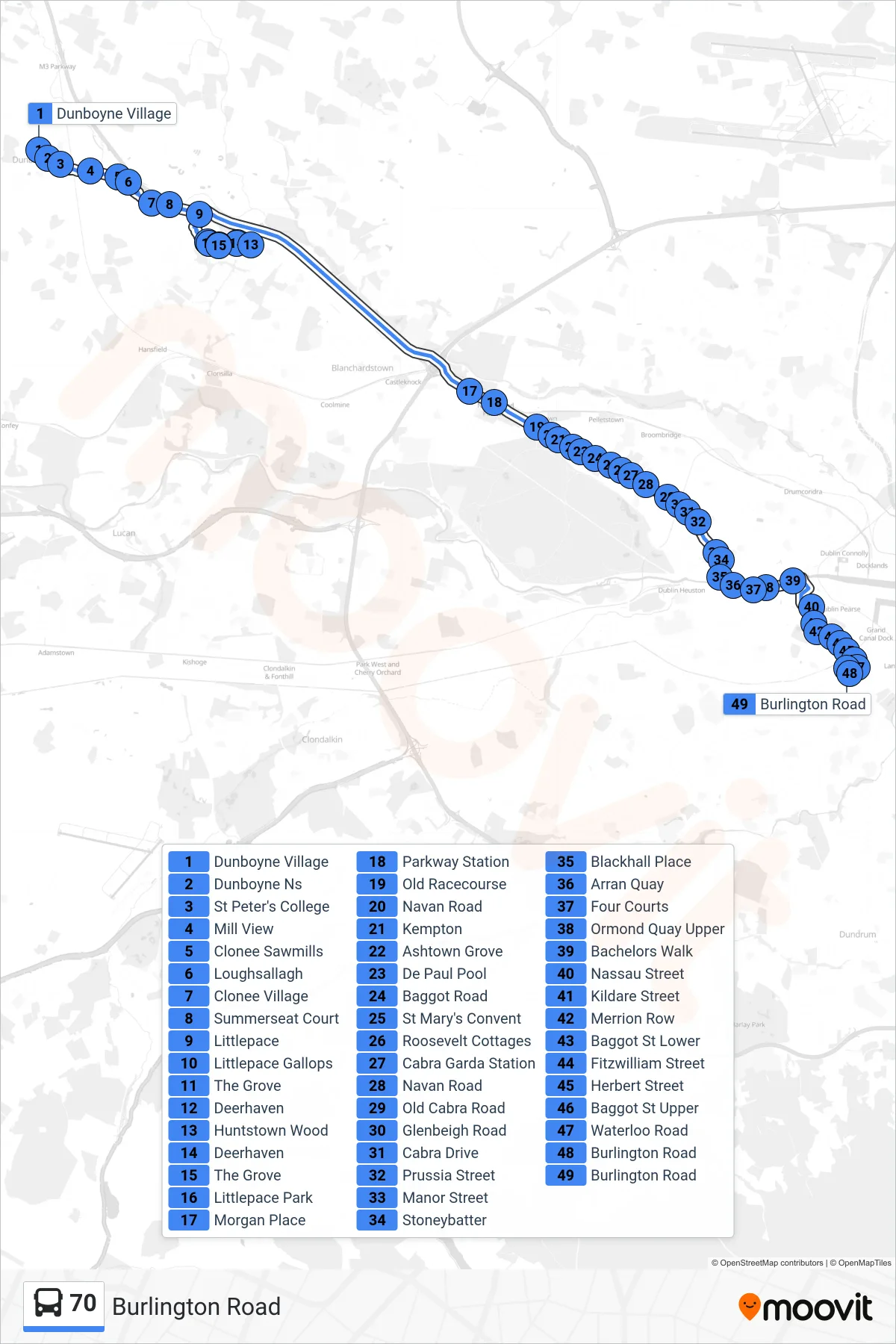
Stops list (70 - Burlington Road)
- Dunboyne Village
- Dunboyne Ns
- St Peter's College
- Mill View
- Clonee Sawmills
- Loughsallagh
- Clonee Village
- Summerseat Court
- Littlepace
- Littlepace Gallops
- The Grove
- Deerhaven
- Huntstown Wood
- Deerhaven
- The Grove
- Littlepace Park
- Morgan Place
- Parkway Station
- Old Racecourse
- Navan Road
- Kempton
- Ashtown Grove
- De Paul Pool
- Baggot Road
- St Mary's Convent
- Roosevelt Cottages
- Cabra Garda Station
- Navan Road
- Old Cabra Road
- Glenbeigh Road
- Cabra Drive
- Prussia Street
- Manor Street
- Stoneybatter
- Blackhall Place
- Arran Quay
- Four Courts
- Ormond Quay Upper
- Bachelors Walk
- Nassau Street
- Kildare Street
- Merrion Row
- Baggot St Lower
- Fitzwilliam Street
- Herbert Street
- Baggot St Upper
- Waterloo Road
- Burlington Road
- Burlington Road