
70 Bus Route Map
View the 70 route map and see all 70 stops along the route. The map of 70 shows where the bus travels and the location of each stop, making it easy to understand the entire route at a glance.
Explore Dan routes on the map and see where Dan bus services operate. Use the 70 map to find bus stops and see how the 70 connects different areas along its trip.
All 70 stops on the map are displayed in route order, helping you follow the 70 bus from the first stop to the last.
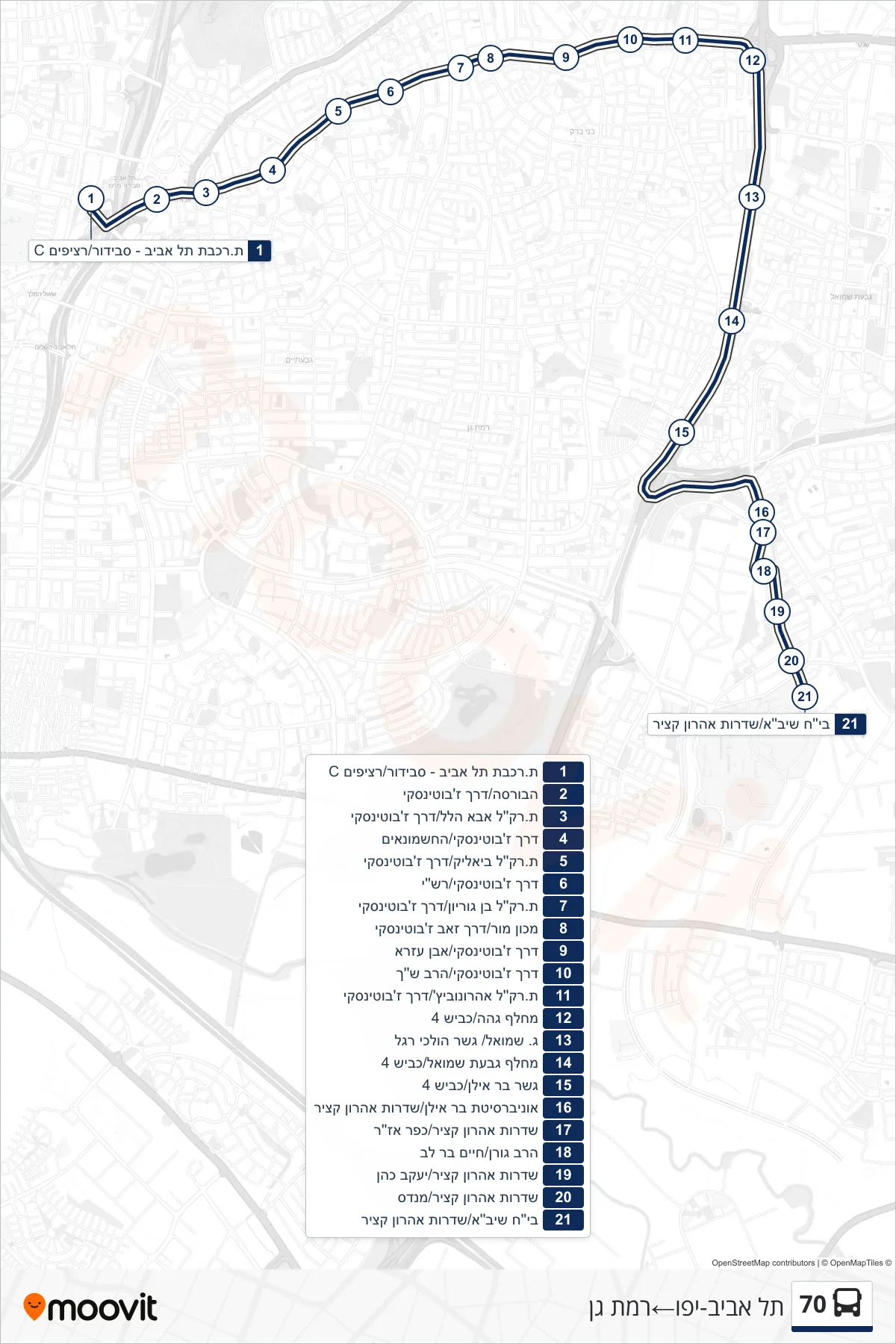
Stops list (70 - Tel Aviv-Yafo→Ramat Gan)
- Tel Aviv - Savidor Railway Station/Platform C
- The Bursa/Jabotinsky Road
- Aba Hillel Light Rail Station/Jabotinsky Road
- Jabotinsky Road/HaChashmonaim
- Bialik Light Rail Station/Jabotinsky Road
- Jabotinsky Road/Rashi
- Ben Gurion Light Rail Station/Jabotinsky Road
- Mor Institute/Zeev Jabotinsky Road
- Jabotinsky Road/Ibn Ezra
- Jabotinsky Road/Rav Shach
- Aharonowitz Light Rail Station/Jabotinsky Road
- Geha Interchange/Road 4
- G. Shmuel/Pedestrian Bridge
- Givat Shmuel Interchange/Road 4
- Bar Ilan Bridge/Road 4
- Bar Ilan University/Aharon Katzir Boulevard
- Sderot Aharon Katzir/Kfar Azar
- Rabbi Goren/Chaim Bar Lev
- Aharon Katzir Boulevard/Yaakov Cohen
- Aharon Katzir Boulevard/Mendes
- Sheba Hospital/Aharon Katzir Boulevard