
70 Bus Route Map
View the 70 route map and see all 70 stops along the route. The map of 70 shows where the bus travels and the location of each stop, making it easy to understand the entire route at a glance.
Explore NJ Transit routes on the map and see where NJ Transit bus services operate. Use the 70 map to find bus stops and see how the 70 connects different areas along its trip.
All 70 stops on the map are displayed in route order, helping you follow the 70 bus from the first stop to the last.
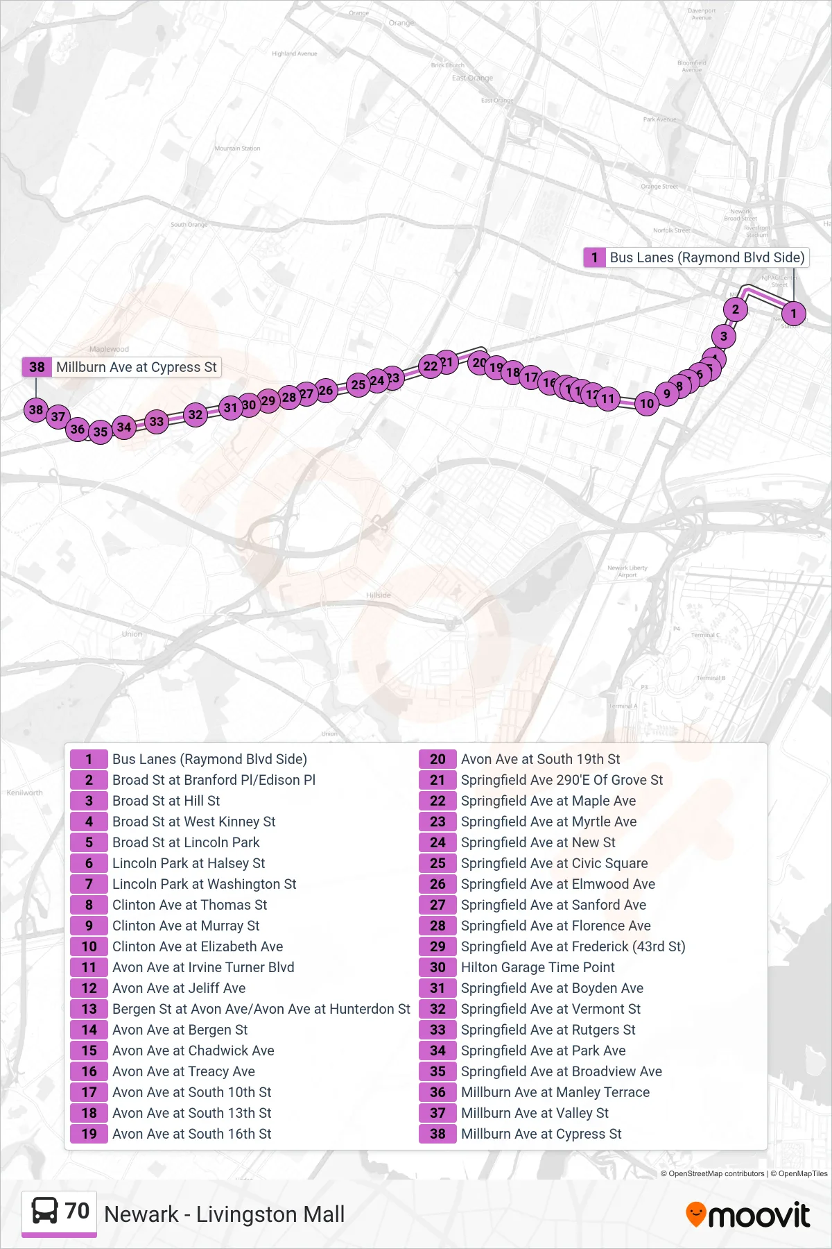
Stops list (70 - Maplewood Loop)
- Bus Lanes (Raymond Blvd Side)
- Broad St at Branford Pl/Edison Pl
- Broad St at Hill St
- Broad St at West Kinney St
- Broad St at Lincoln Park
- Lincoln Park at Halsey St
- Lincoln Park at Washington St
- Clinton Ave at Thomas St
- Clinton Ave at Murray St
- Clinton Ave at Elizabeth Ave
- Avon Ave at Irvine Turner Blvd
- Avon Ave at Jeliff Ave
- Bergen St at Avon Ave/Avon Ave at Hunterdon St
- Avon Ave at Bergen St
- Avon Ave at Chadwick Ave
- Avon Ave at Treacy Ave
- Avon Ave at South 10th St
- Avon Ave at South 13th St
- Avon Ave at South 16th St
- Avon Ave at South 19th St
- Springfield Ave 290'E Of Grove St
- Springfield Ave at Maple Ave
- Springfield Ave at Myrtle Ave
- Springfield Ave at New St
- Springfield Ave at Civic Square
- Springfield Ave at Elmwood Ave
- Springfield Ave at Sanford Ave
- Springfield Ave at Florence Ave
- Springfield Ave at Frederick (43rd St)
- Hilton Garage Time Point
- Springfield Ave at Boyden Ave
- Springfield Ave at Vermont St
- Springfield Ave at Rutgers St
- Springfield Ave at Park Ave
- Springfield Ave at Broadview Ave
- Millburn Ave at Manley Terrace
- Millburn Ave at Valley St
- Millburn Ave at Cypress St
Change direction
- Route Map - 70 - Short Hills Hilton Hotel
- Route Map - 70 - Summit
- Route Map - 70 - Short Hills Mall
- Route Map - 70 - Livingston Mal Via Vauxhall
- Route Map - 70 - Newark Penn Station
- Route Map - 70 - Short Hills Hilton Hotel Livingston Mal Via Vauxhall
- Route Map - 70 - Newark Penn Station Via Vauxhall
- Route Map - 70 - Short Hills Hilton Hotel Via Vauxhall
- Route Map - 70 - Florham Park
- Route Map - 70 - Short Hills Ml Via Vauxhall
- Route Map - 70 - Livingston Mall