
70 Bus Route Map
View the 70 route map and see all 70 stops along the route. The map of 70 shows where the bus travels and the location of each stop, making it easy to understand the entire route at a glance.
Explore AC Transit routes on the map and see where AC Transit bus services operate. Use the 70 map to find bus stops and see how the 70 connects different areas along its trip.
All 70 stops on the map are displayed in route order, helping you follow the 70 bus from the first stop to the last.
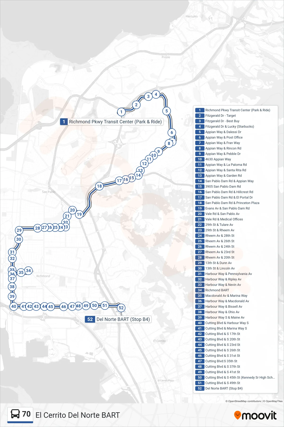
Stops list (70 - El Cerrito Del Norte BART)
- Richmond Pkwy Transit Center (Park & Ride)
- Fitzgerald Dr - Target
- Fitzgerald Dr - Best Buy
- Fitzgerald Dr & Lucky (Starbucks)
- Appian Way & Dalessi Dr
- Appian Way & Post Office
- Appian Way & Fran Way
- Appian Way & Rincon Rd
- Appian Way & Pebble Dr
- 4630 Appian Way
- Appian Way & La Paloma Rd
- Appian Way & Santa Rita Rd
- Appian Way & Garden Rd
- San Pablo Dam Rd & Appian Way
- 3905 San Pablo Dam Rd
- San Pablo Dam Rd & Hillcrest Rd
- San Pablo Dam Rd & El Portal Dr
- San Pablo Dam Rd & Princeton Plaza
- Evans Av & San Pablo Dam Rd
- Vale Rd & San Pablo Av
- Vale Rd & Medical Offices
- 29th St & Tulare Av
- 29th St & Rheem Av
- Rheem Av & 28th St
- Rheem Av & 26th St
- Rheem Av & 24th St
- Rheem Av & 23rd St
- Rheem Av & 20th St
- 13th St & Dunn Av
- 13th St & Lincoln Av
- Harbour Way & Pennsylvania Av
- Harbour Way & Ripley Av
- Harbour Way & Nevin Av
- Richmond BART
- Macdonald Av & Marina Way
- Harbour Way & Macdonald Av
- Harbour Way & Bissell Av
- Harbour Way & Ohio Av
- Harbour Way S & Maine Av
- Cutting Blvd & Harbour Way S
- Cutting Blvd & Marina Way S
- Cutting Blvd & S 17th St
- Cutting Blvd & S 20th St
- Cutting Blvd & S 23rd St
- Cutting Blvd & S 26th St
- Cutting Blvd & S 31st St
- Cutting Blvd:S 35th St
- Cutting Blvd & S 37th St
- Cutting Blvd & S 41st St
- Cutting Blvd & S 45th St (Kennedy Sr High School)
- Cutting Blvd & S 49th St
- Del Norte BART (Stop B4)