
706 Bus Route Map
View the 706 route map and see all 706 stops along the route. The map of 706 shows where the bus travels and the location of each stop, making it easy to understand the entire route at a glance.
Explore DB Regio Bus Mitte GmbH1 routes on the map and see where DB Regio Bus Mitte GmbH1 bus services operate. Use the 706 map to find bus stops and see how the 706 connects different areas along its trip.
All 706 stops on the map are displayed in route order, helping you follow the 706 bus from the first stop to the last.
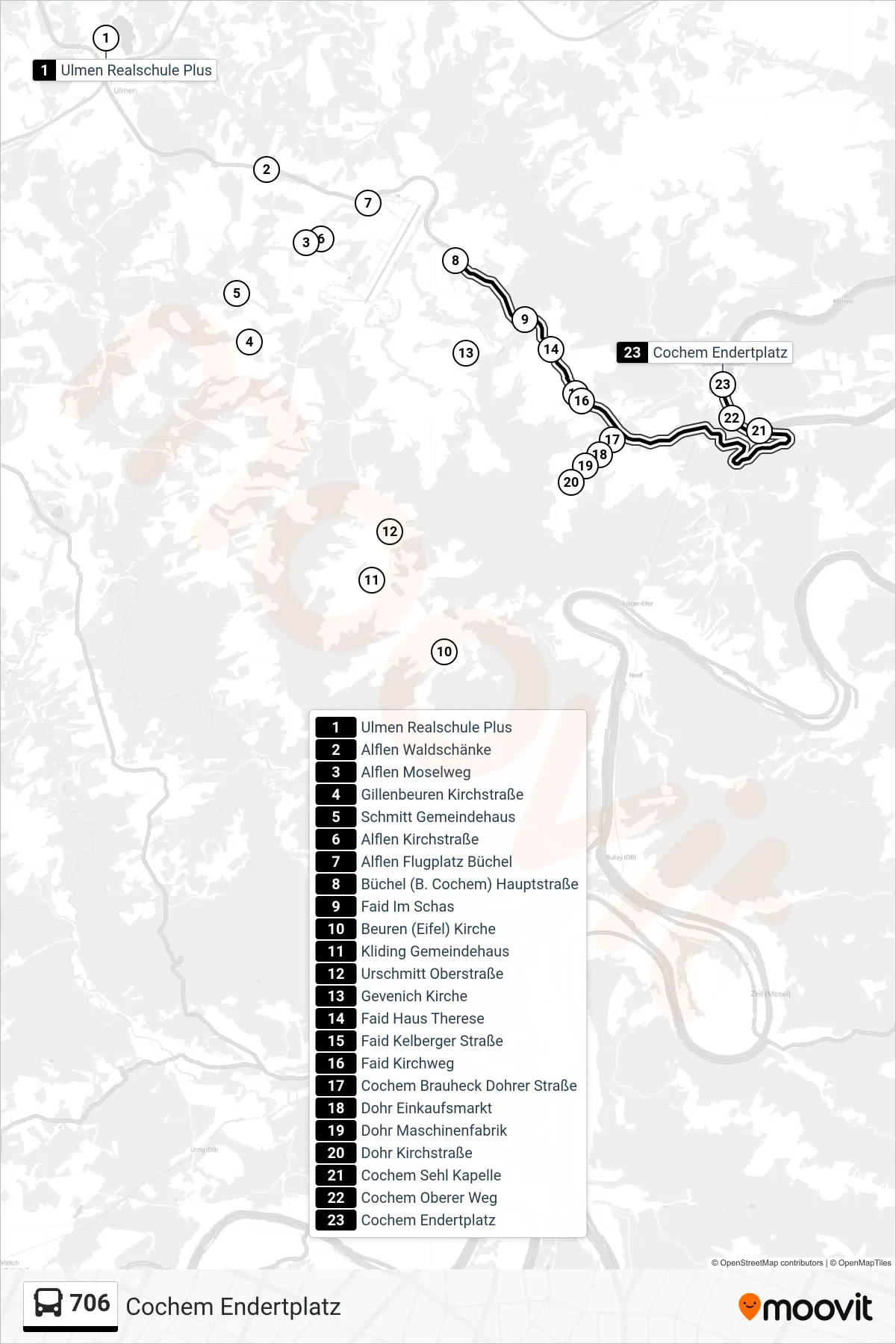
Stops list (706 - Cochem Endertplatz)
- Ulmen Realschule Plus
- Alflen Waldschänke
- Alflen Moselweg
- Gillenbeuren Kirchstraße
- Schmitt Gemeindehaus
- Alflen Kirchstraße
- Alflen Flugplatz Büchel
- Büchel (B. Cochem) Hauptstraße
- Faid Im Schas
- Beuren (Eifel) Kirche
- Kliding Gemeindehaus
- Urschmitt Oberstraße
- Gevenich Kirche
- Faid Haus Therese
- Faid Kelberger Straße
- Faid Kirchweg
- Cochem Brauheck Dohrer Straße
- Dohr Einkaufsmarkt
- Dohr Maschinenfabrik
- Dohr Kirchstraße
- Cochem Sehl Kapelle
- Cochem Oberer Weg
- Cochem Endertplatz
Change direction
- Route Map - 706 - Beuren (Eifel) Kirche
- Route Map - 706 - Lutzerath Schulzentrum
- Route Map - 706 - Büchel (B. Cochem) Hauptstraße
- Route Map - 706 - Dohr Kirchstraße
- Route Map - 706 - Gillenbeuren Kirchstraße
- Route Map - 706 - Schmitt Gemeindehaus
- Route Map - 706 - Büchel (B. Cochem) Hauptstraße
- Route Map - 706 - Faid Kirchweg