
710 Bus Route Map
View the 710 route map and see all 710 stops along the route. The map of 710 shows where the bus travels and the location of each stop, making it easy to understand the entire route at a glance.
Explore RegioBus Steiermark routes on the map and see where RegioBus Steiermark bus services operate. Use the 710 map to find bus stops and see how the 710 connects different areas along its trip.
All 710 stops on the map are displayed in route order, helping you follow the 710 bus from the first stop to the last.
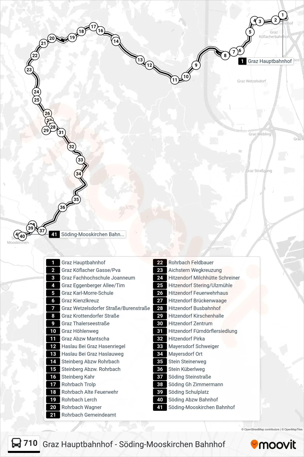
Stops list (710 - Söding-Mooskirchen Bahnhof)
- Graz Hauptbahnhof
- Graz Köflacher Gasse/Pva
- Graz Fachhochschule Joanneum
- Graz Eggenberger Allee/Tim
- Graz Karl-Morre-Schule
- Graz Kienzlkreuz
- Graz Wetzelsdorfer Straße/Burenstraße
- Graz Krottendorfer Straße
- Graz Thalerseestraße
- Graz Höhlenweg
- Graz Abzw Mantscha
- Haslau Bei Graz Hasenriegel
- Haslau Bei Graz Haslauweg
- Steinberg Abzw Rohrbach
- Steinberg Abzw. Rohrbach
- Steinberg Kahr
- Rohrbach Trolp
- Rohrbach Alte Feuerwehr
- Rohrbach Lerch
- Rohrbach Wagner
- Rohrbach Gemeindeamt
- Rohrbach Feldbauer
- Aichstern Wegkreuzung
- Hitzendorf Milchhütte Schreiner
- Hitzendorf Stering/Ulzmühle
- Hitzendorf Feuerwehrhaus
- Hitzendorf Brückenwaage
- Hitzendorf Busbahnhof
- Hitzendorf Kirschenhalle
- Hitzendorf Zentrum
- Hitzendorf Fürndörflersiedlung
- Hitzendorf Pirka
- Mayersdorf Schweiger
- Mayersdorf Ort
- Stein Steinerweg
- Stein Küberlweg
- Söding Steinstraße
- Söding Gh Zimmermann
- Söding Schulplatz
- Söding Abzw Bahnhof
- Söding-Mooskirchen Bahnhof