
712 Bus Route Map
View the 712 route map and see all 712 stops along the route. The map of 712 shows where the bus travels and the location of each stop, making it easy to understand the entire route at a glance.
Explore MBTA routes on the map and see where MBTA bus services operate. Use the 712 map to find bus stops and see how the 712 connects different areas along its trip.
All 712 stops on the map are displayed in route order, helping you follow the 712 bus from the first stop to the last.
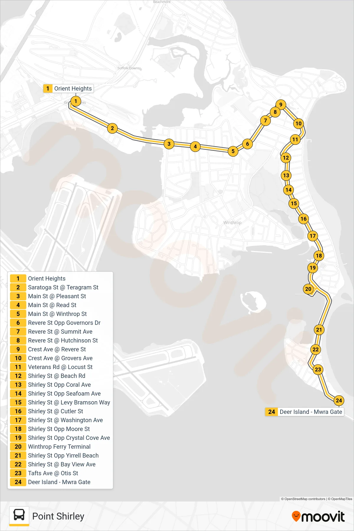
Stops list (712 - Point Shirley)
- Orient Heights
- Saratoga St @ Teragram St
- Main St @ Pleasant St
- Main St @ Read St
- Main St @ Winthrop St
- Revere St Opp Governors Dr
- Revere St @ Summit Ave
- Revere St @ Hutchinson St
- Crest Ave @ Revere St
- Crest Ave @ Grovers Ave
- Veterans Rd @ Locust St
- Shirley St @ Beach Rd
- Shirley St Opp Coral Ave
- Shirley St Opp Seafoam Ave
- Shirley St @ Levy Bramson Way
- Shirley St @ Cutler St
- Shirley St @ Washington Ave
- Shirley St Opp Moore St
- Shirley St Opp Crystal Cove Ave
- Winthrop Ferry Terminal
- Shirley St Opp Yirrell Beach
- Shirley St @ Bay View Ave
- Tafts Ave @ Otis St
- Deer Island - Mwra Gate