
714 Bus Route Map
View the 714 route map and see all 714 stops along the route. The map of 714 shows where the bus travels and the location of each stop, making it easy to understand the entire route at a glance.
Explore MBTA routes on the map and see where MBTA bus services operate. Use the 714 map to find bus stops and see how the 714 connects different areas along its trip.
All 714 stops on the map are displayed in route order, helping you follow the 714 bus from the first stop to the last.
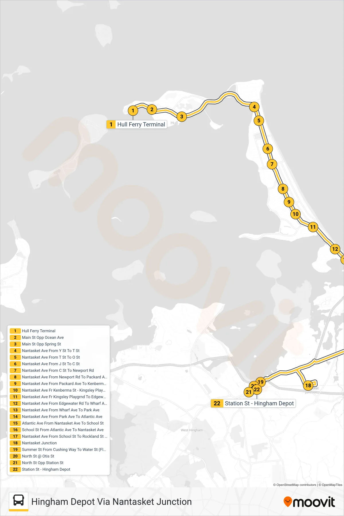
Stops list (714 - Hingham Depot Via Nantasket Junction)
- Hull Ferry Terminal
- Main St Opp Ocean Ave
- Main St Opp Spring St
- Nantasket Ave From Y St To T St
- Nantasket Ave From T St To O St
- Nantasket Ave From J St To C St
- Nantasket Ave From C St To Newport Rd
- Nantasket Ave From Newport Rd To Packard Ave
- Nantasket Ave From Packard Ave To Kenberma St
- Nantasket Ave Fr Kenberma St - Kingsley Playground
- Nantasket Ave Fr Kingsley Playgrnd To Edgewater Rd
- Nantasket Ave From Edgewater Rd To Wharf Ave
- Nantasket Ave From Wharf Ave To Park Ave
- Nantasket Ave From Park Ave To Atlantic Ave
- Atlantic Ave From Nantasket Ave To School St
- School St From Atlantic Ave To Nantasket Ave
- Nantasket Ave From School St To Rockland St (Flag)
- Nantasket Junction
- Summer St From Cushing Way To Water St (Flag)
- North St @ Otis St
- North St Opp Station St
- Station St - Hingham Depot