
71A Bus Route Map
View the 71A route map and see all 71A stops along the route. The map of 71A shows where the bus travels and the location of each stop, making it easy to understand the entire route at a glance.
Explore Pittsburgh Regional Transit routes on the map and see where Pittsburgh Regional Transit bus services operate. Use the 71A map to find bus stops and see how the 71A connects different areas along its trip.
All 71A stops on the map are displayed in route order, helping you follow the 71A bus from the first stop to the last.
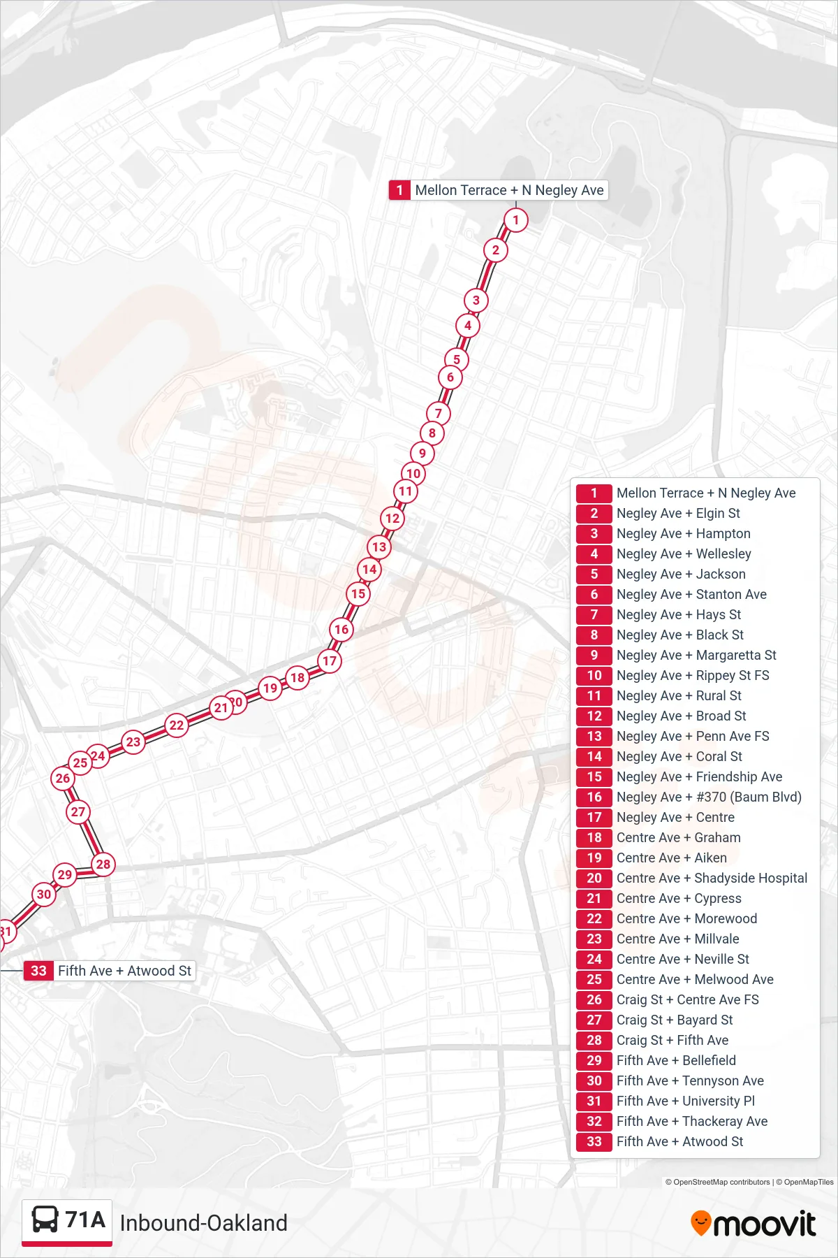
Stops list (71A - Inbound-Oakland)
- Mellon Terrace + N Negley Ave
- Negley Ave + Elgin St
- Negley Ave + Hampton
- Negley Ave + Wellesley
- Negley Ave + Jackson
- Negley Ave + Stanton Ave
- Negley Ave + Hays St
- Negley Ave + Black St
- Negley Ave + Margaretta St
- Negley Ave + Rippey St FS
- Negley Ave + Rural St
- Negley Ave + Broad St
- Negley Ave + Penn Ave FS
- Negley Ave + Coral St
- Negley Ave + Friendship Ave
- Negley Ave + #370 (Baum Blvd)
- Negley Ave + Centre
- Centre Ave + Graham
- Centre Ave + Aiken
- Centre Ave + Shadyside Hospital
- Centre Ave + Cypress
- Centre Ave + Morewood
- Centre Ave + Millvale
- Centre Ave + Neville St
- Centre Ave + Melwood Ave
- Craig St + Centre Ave FS
- Craig St + Bayard St
- Craig St + Fifth Ave
- Fifth Ave + Bellefield
- Fifth Ave + Tennyson Ave
- Fifth Ave + University Pl
- Fifth Ave + Thackeray Ave
- Fifth Ave + Atwood St