
724 Bus Route Map
View the 724 route map and see all 724 stops along the route. The map of 724 shows where the bus travels and the location of each stop, making it easy to understand the entire route at a glance.
Explore RVS routes on the map and see where RVS bus services operate. Use the 724 map to find bus stops and see how the 724 connects different areas along its trip.
All 724 stops on the map are displayed in route order, helping you follow the 724 bus from the first stop to the last.
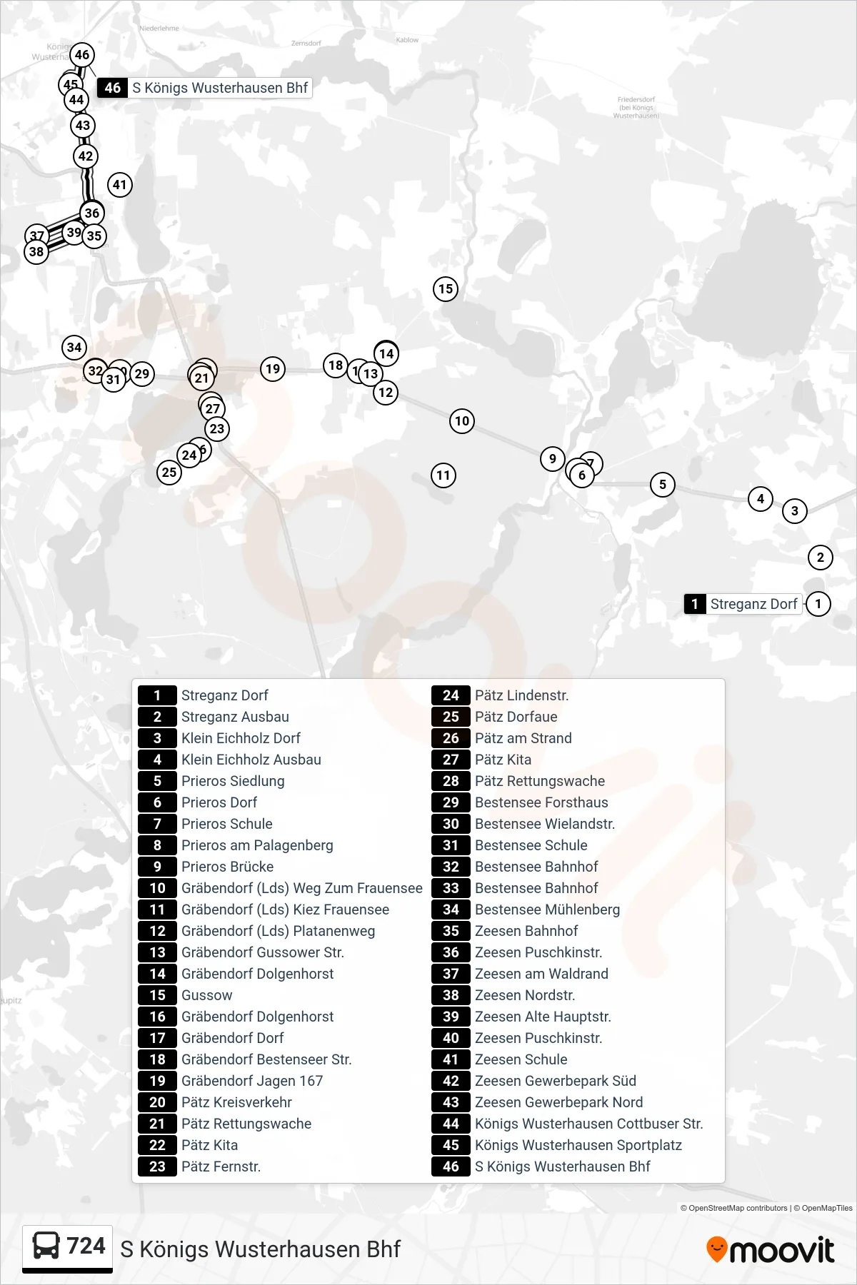
Stops list (724 - S Königs Wusterhausen Bhf)
- Streganz Dorf
- Streganz Ausbau
- Klein Eichholz Dorf
- Klein Eichholz Ausbau
- Prieros Siedlung
- Prieros Dorf
- Prieros Schule
- Prieros am Palagenberg
- Prieros Brücke
- Gräbendorf (Lds) Weg Zum Frauensee
- Gräbendorf (Lds) Kiez Frauensee
- Gräbendorf (Lds) Platanenweg
- Gräbendorf Gussower Str.
- Gräbendorf Dolgenhorst
- Gussow
- Gräbendorf Dolgenhorst
- Gräbendorf Dorf
- Gräbendorf Bestenseer Str.
- Gräbendorf Jagen 167
- Pätz Kreisverkehr
- Pätz Rettungswache
- Pätz Kita
- Pätz Fernstr.
- Pätz Lindenstr.
- Pätz Dorfaue
- Pätz am Strand
- Pätz Kita
- Pätz Rettungswache
- Bestensee Forsthaus
- Bestensee Wielandstr.
- Bestensee Schule
- Bestensee Bahnhof
- Bestensee Bahnhof
- Bestensee Mühlenberg
- Zeesen Bahnhof
- Zeesen Puschkinstr.
- Zeesen am Waldrand
- Zeesen Nordstr.
- Zeesen Alte Hauptstr.
- Zeesen Puschkinstr.
- Zeesen Schule
- Zeesen Gewerbepark Süd
- Zeesen Gewerbepark Nord
- Königs Wusterhausen Cottbuser Str.
- Königs Wusterhausen Sportplatz
- S Königs Wusterhausen Bhf
Change direction
- Route Map - 724 - Bindow Grüne Trift
- Route Map - 724 - Streganz Dorf
- Route Map - 724 - Prieros Dorf
- Route Map - 724 - Bestensee Bahnhof
- Route Map - 724 - Prieros Schule
- Route Map - 724 - Zeesen Puschkinstr.
- Route Map - 724 - Prieros Siedlung
- Route Map - 724 - Pätz Dorfaue
- Route Map - 724 - Bestensee Friedenstr.