
73 Bus Route Map
View the 73 route map and see all 73 stops along the route. The map of 73 shows where the bus travels and the location of each stop, making it easy to understand the entire route at a glance.
Explore SEPTA routes on the map and see where SEPTA bus services operate. Use the 73 map to find bus stops and see how the 73 connects different areas along its trip.
All 73 stops on the map are displayed in route order, helping you follow the 73 bus from the first stop to the last.
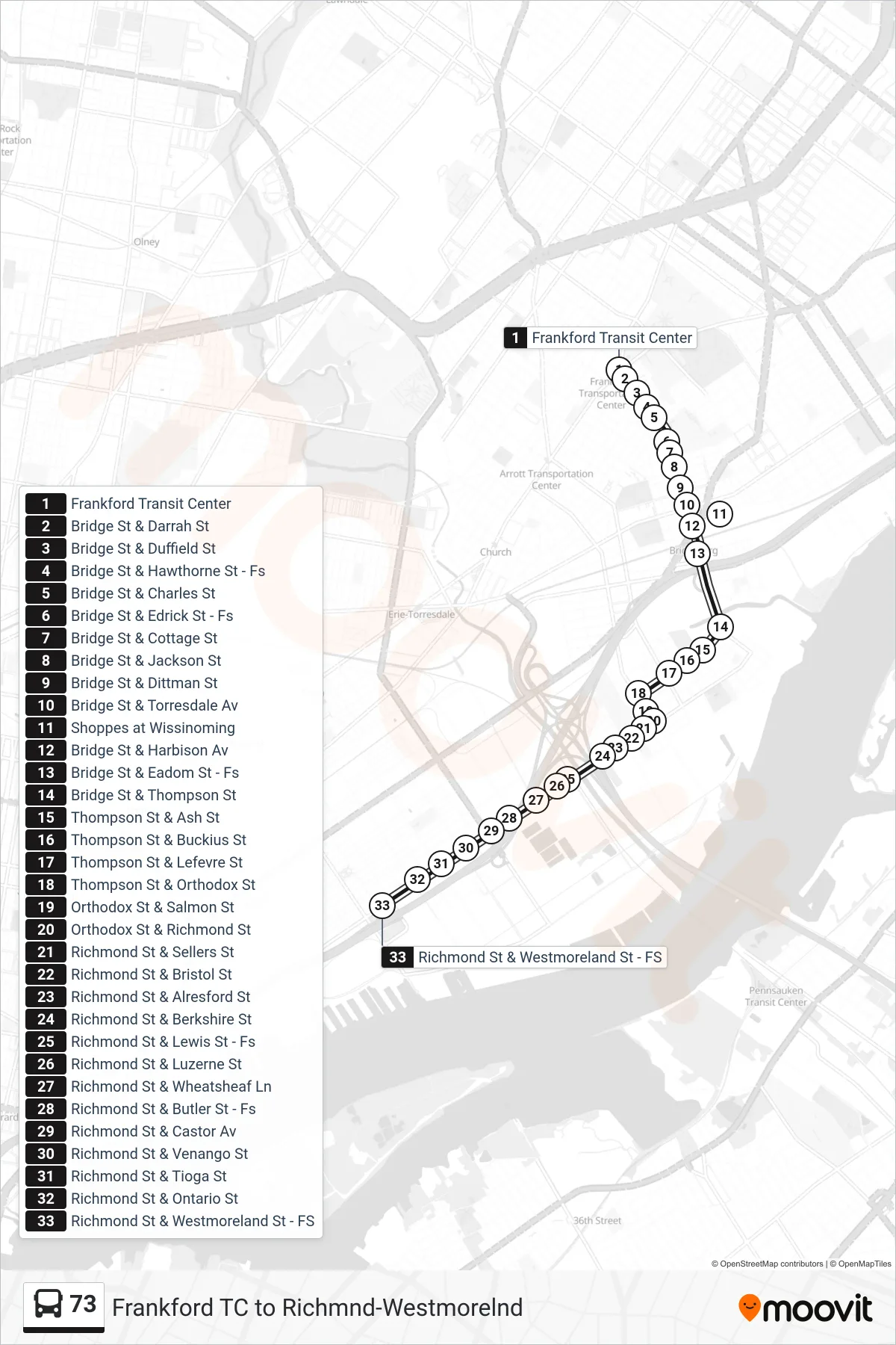
Stops list (73 - Richmond-Westmoreland)
- Frankford Transit Center
- Bridge St & Darrah St
- Bridge St & Duffield St
- Bridge St & Hawthorne St - Fs
- Bridge St & Charles St
- Bridge St & Edrick St - Fs
- Bridge St & Cottage St
- Bridge St & Jackson St
- Bridge St & Dittman St
- Bridge St & Torresdale Av
- Shoppes at Wissinoming
- Bridge St & Harbison Av
- Bridge St & Eadom St - Fs
- Bridge St & Thompson St
- Thompson St & Ash St
- Thompson St & Buckius St
- Thompson St & Lefevre St
- Thompson St & Orthodox St
- Orthodox St & Salmon St
- Orthodox St & Richmond St
- Richmond St & Sellers St
- Richmond St & Bristol St
- Richmond St & Alresford St
- Richmond St & Berkshire St
- Richmond St & Lewis St - Fs
- Richmond St & Luzerne St
- Richmond St & Wheatsheaf Ln
- Richmond St & Butler St - Fs
- Richmond St & Castor Av
- Richmond St & Venango St
- Richmond St & Tioga St
- Richmond St & Ontario St
- Richmond St & Westmoreland St - FS