
736 Bus Route Map
View the 736 route map and see all 736 stops along the route. The map of 736 shows where the bus travels and the location of each stop, making it easy to understand the entire route at a glance.
Explore Movia routes on the map and see where Movia bus services operate. Use the 736 map to find bus stops and see how the 736 connects different areas along its trip.
All 736 stops on the map are displayed in route order, helping you follow the 736 bus from the first stop to the last.
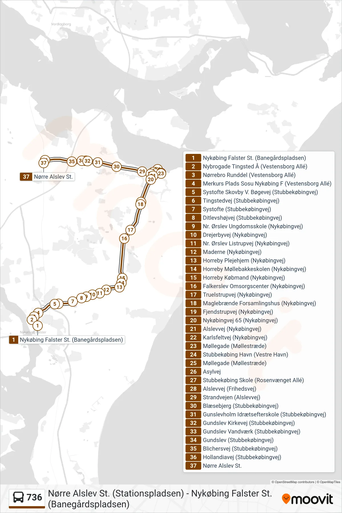
Stops list (736 - Nørre Alslev St. (Stationspladsen))
- Nykøbing Falster St. (Banegårdspladsen)
- Nybrogade Tingsted Å (Vestensborg Allé)
- Nørrebro Runddel (Vestensborg Allé)
- Merkurs Plads Sosu Nykøbing F (Vestensborg Allé)
- Systofte Skovby V. Bøgevej (Stubbekøbingvej)
- Tingstedvej (Stubbekøbingvej)
- Systofte (Stubbekøbingvej)
- Ditlevshøjvej (Stubbekøbingvej)
- Nr. Ørslev Ungdomsskole (Nykøbingvej)
- Drejerbyvej (Nykøbingvej)
- Nr. Ørslev Listrupvej (Nykøbingvej)
- Maderne (Nykøbingvej)
- Horreby Plejehjem (Nykøbingvej)
- Horreby Møllebakkeskolen (Nykøbingvej)
- Horreby Købmand (Nykøbingvej)
- Falkerslev Omsorgscenter (Nykøbingvej)
- Truelstrupvej (Nykøbingvej)
- Maglebrænde Forsamlingshus (Nykøbingvej)
- Fjendstrupvej (Nykøbingvej)
- Nykøbingvej 65 (Nykøbingvej)
- Alslevvej (Nykøbingvej)
- Karlsfeltvej (Nykøbingvej)
- Møllegade (Møllestræde)
- Stubbekøbing Havn (Vestre Havn)
- Møllegade (Møllestræde)
- Asylvej
- Stubbekøbing Skole (Rosenvænget Allé)
- Alslevvej (Frihedsvej)
- Strandvejen (Alslevvej)
- Blæsebjerg (Stubbekøbingvej)
- Gunslevholm Idrætsefterskole (Stubbekøbingvej)
- Gundslev Kirkevej (Stubbekøbingvej)
- Gundslev Vandværk (Stubbekøbingvej)
- Gundslev (Stubbekøbingvej)
- Blichersvej (Stubbekøbingvej)
- Hollandiavej (Stubbekøbingvej)
- Nørre Alslev St.