
736 Bus Route Map
View the 736 route map and see all 736 stops along the route. The map of 736 shows where the bus travels and the location of each stop, making it easy to understand the entire route at a glance.
Explore Österreichische Postbus AG routes on the map and see where Österreichische Postbus AG bus services operate. Use the 736 map to find bus stops and see how the 736 connects different areas along its trip.
All 736 stops on the map are displayed in route order, helping you follow the 736 bus from the first stop to the last.
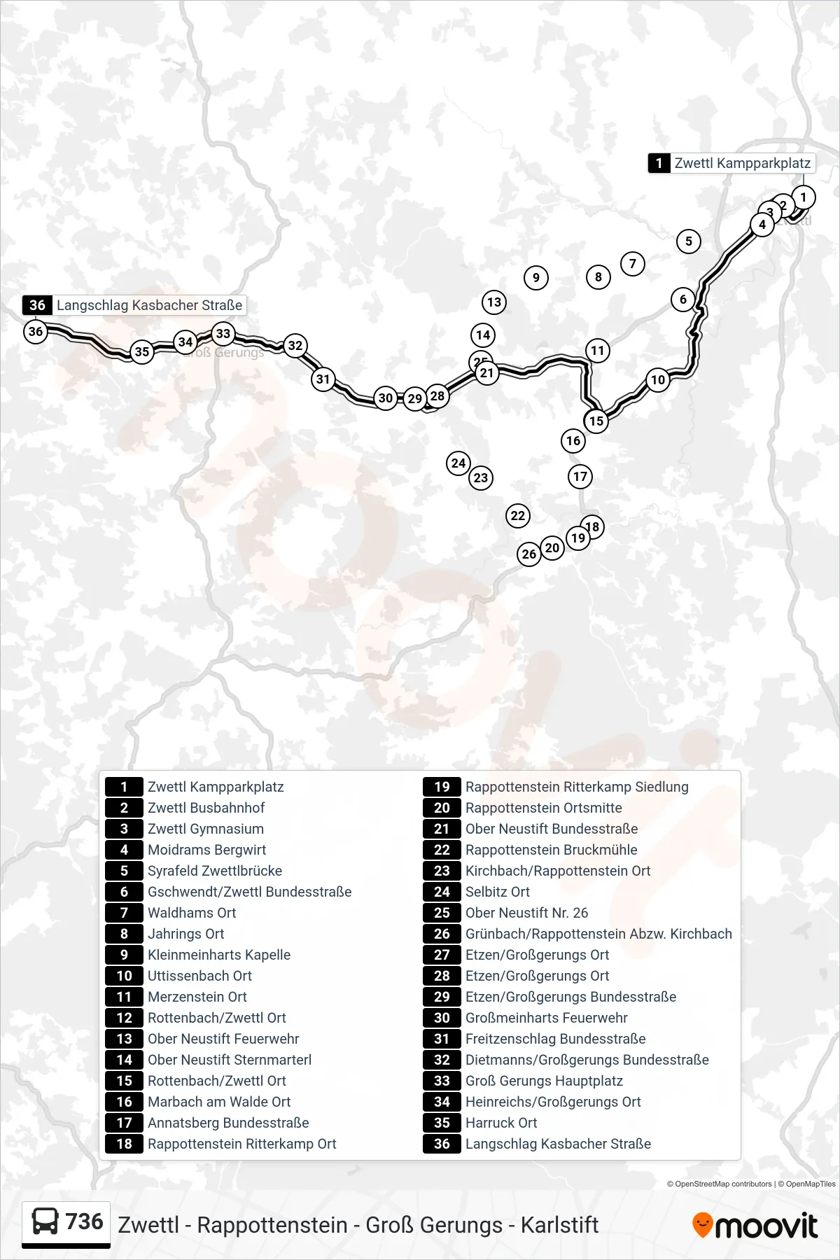
Stops list (736 - Langschlag Kasbacher Straße)
- Zwettl Kampparkplatz
- Zwettl Busbahnhof
- Zwettl Gymnasium
- Moidrams Bergwirt
- Syrafeld Zwettlbrücke
- Gschwendt/Zwettl Bundesstraße
- Waldhams Ort
- Jahrings Ort
- Kleinmeinharts Kapelle
- Uttissenbach Ort
- Merzenstein Ort
- Rottenbach/Zwettl Ort
- Ober Neustift Feuerwehr
- Ober Neustift Sternmarterl
- Rottenbach/Zwettl Ort
- Marbach am Walde Ort
- Annatsberg Bundesstraße
- Rappottenstein Ritterkamp Ort
- Rappottenstein Ritterkamp Siedlung
- Rappottenstein Ortsmitte
- Ober Neustift Bundesstraße
- Rappottenstein Bruckmühle
- Kirchbach/Rappottenstein Ort
- Selbitz Ort
- Ober Neustift Nr. 26
- Grünbach/Rappottenstein Abzw. Kirchbach
- Etzen/Großgerungs Ort
- Etzen/Großgerungs Ort
- Etzen/Großgerungs Bundesstraße
- Großmeinharts Feuerwehr
- Freitzenschlag Bundesstraße
- Dietmanns/Großgerungs Bundesstraße
- Groß Gerungs Hauptplatz
- Heinreichs/Großgerungs Ort
- Harruck Ort
- Langschlag Kasbacher Straße
Change direction
- Route Map - 736 - Groß Gerungs Schulen
- Route Map - 736 - Kamp/Arbesbach Bundesstraße
- Route Map - 736 - Etzen/Großgerungs Ort
- Route Map - 736 - Zwettl Kampparkplatz
- Route Map - 736 - Karlstift B38/Abzw. Ort
- Route Map - 736 - Arbesbach Ortsmitte
- Route Map - 736 - Groß Gerungs Hauptplatz
- Route Map - 736 - Groß Gerungs Hauptplatz
- Route Map - 736 - Etzen/Großgerungs Ort