
74 Bus Route Map
View the 74 route map and see all 74 stops along the route. The map of 74 shows where the bus travels and the location of each stop, making it easy to understand the entire route at a glance.
Explore Bus Átha Cliath – Dublin Bus routes on the map and see where Bus Átha Cliath – Dublin Bus bus services operate. Use the 74 map to find bus stops and see how the 74 connects different areas along its trip.
All 74 stops on the map are displayed in route order, helping you follow the 74 bus from the first stop to the last.
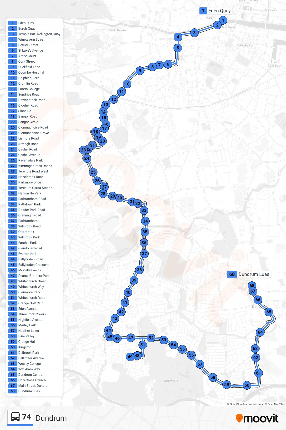
Stops list (74 - Dundrum)
- Eden Quay
- Burgh Quay
- Temple Bar, Wellington Quay
- Winetavern Street
- Patrick Street
- St Luke's Avenue
- Ardee Court
- Cork Street
- Brickfield Lane
- Coombe Hospital
- Dolphin's Barn
- Crumlin Road
- Loreto College
- Sundrive Road
- Downpatrick Road
- Clogher Road
- Slane Rd
- Bangor Road
- Bangor Circle
- Clonmacnoise Road
- Clonmacnoise Grove
- Lismore Road
- Armagh Road
- Cashel Road
- Cashel Avenue
- Ravensdale Park
- Kimmage Cross Roads
- Terenure Road West
- Hazelbrook Road
- Parkmore Drive
- Terenure Garda Station
- Hannaville Park
- Rathfarnham Road
- Rathdown Park
- Dodder Park Road
- Crannagh Road
- Rathfarnham
- Willbrook Road
- Otterbrook
- Willbrook Park
- Fonthill Park
- Glendoher Road
- Everton Hall
- Ballyboden Road
- Ballyboden Crescent
- Moyville Lawns
- Pearse Brothers Park
- Whitechurch Green
- Whitechurch Way
- Glenmore Park
- Whitechurch Road
- Grange Golf Club
- Eden Avenue
- Three Rock Rovers
- Highfield Avenue
- Marlay Park
- Heather Lawn
- Pine Valley
- Grange Hall
- Kingston
- Delbrook Park
- Ballinteer Avenue
- Wesley College
- Wyckham Way
- Dundrum Centre
- Holy Cross Church
- Main Street, Dundrum
- Dundrum Luas